If you have spent any time on my website, you know that I am someone who heeds the call of adventure. I work as an outdoor guide, do not have a permanent address, and spend most of my free time planning my next trip.
South America had long been at the top of my list of places to visit for a number of reasons. Learning Spanish had been a long-term goal of mine, so I wanted to travel to a Spanish-speaking part of the world to practice. In addition, I had always imagined South America as a continent full of beautiful landscapes and adventures waiting to be had. It certainly delivered in these regards, but I soon learned that it has a whole lot more to offer than just adventure.
General Outline
During my travels, I visited every Spanish-speaking country in South America except Venezuela. I would love to visit Venezuela someday, but I did not travel there because it was under a Do Not Travel advisory for the entirety of my trip.
I traveled from September 2022 until April 2023, on a route that took me from Bogotá, Colombia to Punta Arenas, Chile. All of my travel between those two cities was done entirely by road or by water, and along the way I traveled through Colombia, Ecuador, Peru, Bolivia, Paraguay, Argentina, Chile, and a little bit of Uruguay.
The route I took through South America.
I worked hard to make my experiences as diverse as possible. I visited large cities, rural areas, coasts, the Andes, and the Amazon. I fished for piranhas, visited large, modern cities, and even worked on a farm. Where I could, I stayed with locals that I met either through the app Couchsurfing or through mutual friends. To improve my Spanish, I went to great lengths to immerse myself among the people and culture of every place I visited.
Lessons Learned
The seven months I spent traveling across South America were some of the most trying and rewarding of my life. It is no understatement to say that it was a life-changing experience that I will be mentally unpacking for years to come. That being said, there are a few lessons that really stand out, and I will explain them below.
Learning Spanish
Like many Americans, I grew up only speaking English. I had studied Spanish for a few years in high school, but in my head, learning another language was something I thought was only possible for small children or people with a genius-level intellect. But during my travels, I learned that languages, like everything else, are just skills that anyone can build through consistent and disciplined practice.
I took a standardized Spanish proficiency test before and after starting my trip, which revealed that my Spanish level progressed from CEFR level B1 to C1. In layman’s terms, this means that I progressed from an intermediate to a near-fluent level, a jump that typically takes several years in a classroom!
But beyond the results of a language test, I experienced real, applicable improvements that made my travels much more enjoyable. Upon arriving in Colombia, I struggled to understand even basic questions and stared blankly when someone tried to talk to me. But by the end of my trip, I was telling jokes and stories over mates with Argentinians who did not speak a word of English.
The road to that level of proficiency took me through many stressful situations and literal headaches. In addition to forcing myself into situations where I had to speak Spanish, I also studied diligently. Every time I encountered a word I did not know, I added it to a list that I would study every night. After doing this for seven months, that list is over 900 words long, showing that I added nearly 1000 words to my vocabulary during my travels.
I also familiarized myself with many different accents and dialects. One thing that surprised me was just how different some accents can be. I still remember my first conversation with someone from Buenos Aires, which went something like:
Me: What was that? I didn’t quite understand. Can you talk a bit slower?
Her: Okay. Do you even speak Spanish?
Me: Yes, do you?
Even at the end of my trip, I still met the occasional person who spoke in such a way that I could not understand a single word they said. Not a single word. The differences that exist within the Spanish language are enormous, and something that even native speakers struggle with when they travel.
Traveling across South America familiarized me with many different accents, which greatly improved the versatility of my Spanish. I am now familiar with many of the regional differences, like the meaning of the word “coger,” and proper use of the word “chimba.” So next time I visit (and there will be a next time), I will be able to visit many different parts of the Spanish-speaking world with minimal difficulty understanding and being understood.
Empathy
While getting to know locals from across South America, I did not just encounter different accents and ways of speaking. I also met a lot of different kinds of people with different values and different life experiences. Meeting people ended up being one of my favorite parts of the trip, because I learned to appreciate that people can be both astonishingly similar and astonishingly different from myself.
During my hike to the top of the Sumaco Volcano in Ecuador, I spent four days climbing to volcano with my guide, José. Like me, he was a 22-year-old outdoor guide, and our similarities went much further. We had the same sense of humor and laughed at the same jokes. He was independently studying English, just as I had independently studied Spanish. He was even planning a trip to Colombia in which his top destination, the Sumapaz Páramo, was also my favorite spot in Colombia! I realized that the only real reason why we lived different lives and had different opportunities in life was that he was born in an indigenous community in Ecuador, whereas I was born in a large city in the United States. Yet in spite of coming from very different backgrounds, we shared many similarities and got along very well.
Alternatively, my time staying with a Mennonite family in Paraguay showed me just how different people can be. In the town of Filadelfia, I stayed with a German and Spanish-speaking couple to learn more about the Mennonite way of life. During my stay, I got to attend a family reunion with the husband, Rudolf, and meet his 12 brothers and sisters. I also learned about the Mennonite faith, specifically its emphasis on love and pacifism, which led Rudolf’s parents to leave everything behind and move from Russia to rural Paraguay to escape military service. Yet because of and in spite of our differences, I feel we were able to connect with and learn a lot from each other.
Going with Rudolf to take help care of his cows.
I had experiences like these throughout my time in South America. They showed me that while cultures and ways of life can differ greatly, most people, regardless of where they come from, have a lot in common. This realization helped me learn to connect with people on a much deeper level and reach across our differences in background.
Minimalism
At every point during my trip, I had to make sure that my belongings were few enough to fit in a single backpack. At the same time, I traveled to many rural areas where I had to be 100% self-sufficient. This forced me to constantly evaluate and re-evaluate what I carried with me. And as I evaluated and talked to other travelers about what they carried, I realized that, counterintuitively, those who were traveling for the longest often had the smallest backpacks.
This was something I had noticed not just traveling through South America, but also as a wilderness backpacker in the United States. I believe this happens because long-term travelers understand just how few possessions we need to be happy and comfortable. Personally, I found my pack growing smaller over the course of my trip as I learned what I did not need.
In addition, traveling light carries a number of advantages. Just a few of them include being cheaper, making carrying your bag less strenuous, making you less likely to lose things, and allowing you to save time packing and unpacking.
Most importantly, traveling light teaches us a fundamental lesson about life: that the people we meet and the experiences we have are far more important than the things we own. Minimalism is just an extension of this idea because it allows us to spend less time worrying about our things so that we can spend more time experiencing the world
You can see the packing list I created after 7 months of traveling here.
Staying Healthy
During my seven months of travel, I got sick with a fever four different times. I had strep throat, severe traveler’s diarrhea, an unidentified disease that was probably dengue fever, and chikungunya, a relative of dengue. Being sick so many times came as a great surprise to me, especially because I get sick once a year or less during my normal life.
Getting treated for chikungunya in a Paraguayan medical clinic.
Traveling, not surprisingly, is perhaps the best way to get sick. Traveling:
Exposes you to new germs from all around the world.
Puts you into contact with an ever-changing group of strangers.
Weakens your immune system by subjecting you to constant stress from constantly changing surroundings
Makes maintaining habits like regular exercise, healthy eating, and a regular sleep schedule difficult, if not impossible.
And since I started my trip unprepared to deal with these changes, I got sick four different times. But experience is the best teacher, so by the end of my trip I had made some changes to keep this from happening in the future. I started
Keeping hand sanitizer with me at all times and using it regularly.
Wearing masks in crowded public spaces.
Limiting the amount of time I spent in crowded hostel rooms and making sure to keep my distance from anyone who had the sniffles.
Avoiding street food, no matter how delicious it smelled. Food from restaurants and markets never gave me issues.
Making a conscious effort to avoid mosquitoes by staying inside during peak mosquito hours, using bug repellant, and wearing long sleeves and pants.
Above all, setting aside time to relax and recover from the stresses of traveling.
Backpacking, which I define as the style of travel where people travel for an extended period of time and travel quickly from place to place, is really exhausting. For all of the reasons I outlined above, it is both physically and mentally straining in so many ways.
It has a lot of benefits, too. It is a lot of fun and allows you to visit many places relatively cheaply, and puts you in contact with lots of other travelers. But for me, the experience was too draining for me to want to backpack for a long period of time again.
But that does not mean that I am done traveling. Backpacking is just one of a nearly infinite number of ways to see the world. You can also travel to:
Work or volunteer
Study at a foreign university
Take a language course
Take part in a cultural exchange program
Next time I travel, I will pursue one of these options. I had a wonderful time backpacking across South America, and now I want to experience developing deeper ties to one place by traveling in a different way.
After seven months traveling across South America, I have a good idea of what every traveler should bring. The purpose of this list is to maximize versatility, portability, and minimalism. Being versatile means that you would be just as comfortable in a rural mountain town as you would be in a big city. Being portable means that everything does not take up much space in your backpack. Portability also means being a minimalist and bringing only what you need and nothing that you do not. As such, it is important not to bring more than the recommended items without a good reason.
Everything that I carried at the beginning of my 7-month South America trip.
Clothes
This clothing list is complete enough to let you trek through the jungle or sit down for dinner in a nice restaurant. The quantities of clothing should be sufficient for you to do laundry once a week. When it comes to clothing, less is more; if you are not sure if you should bring something, don’t. Clothing is generally cheap and widely available, so anything you find yourself needing you can buy along the way.
Legwear, 3 pairs of the following.
I recommend picking three pairs from the following options, depending on your needs. Three pairs, in my opinion, will give you sufficient versatility without taking up too much space.
Shorts – Shorts are ideal for hot places that do not have many biting insects. This generally means cities and beaches in hot places. Examples include the coast of Colombia and summer in Buenos Aires.
Jeans – Jeans are incredibly versatile and worn daily in many places that do not experience extreme heat. A good pair of jeans can double for both walking around town or going to many clubs and restaurants. If you find jeans uncomfortable, there are a variety of “travel jeans” out there that mix in some other fabrics to make them lighter and more flexible. Jeans are ideal for Andean cities like Bogotá, Quito, and many others.
Softshell pants – Softshell pants are a piece of technical outdoor clothing that breathe well yet are wind and water resistant. They are unparalleled for trekking and camping in the mountains, and some lightweight models are even cool enough to be worn in the Amazon.
Linen pants – Linen pants are fantastic in hot weather. They offer exceptional airflow and can keep your legs as cool as a pair of shorts. Their only downside is that they do not seem to be very common and in many places will, for better or worse, cause you to stick out.
Footwear, 2-3 pairs
I recommend one pair of each of the following, but you can skip the trail runners if you do not plan on hiking. In my experience, the three following types of footwear are sufficient for almost everything offered in South America.
Casual shoes – Whatever style you like.
Sandals – In my opinion, everyone needs a good pair of sandals. More comfortable and versatile than flip-flops, and great for hanging out by the water. They are also essential if you do not want to get athlete’s foot from a hostel shower (speaking from experience).
Trail running shoes – Trail running shoes were sufficient for every unguided hiking or backpacking trip I encountered in South America. The only places they fall short are particularly rugged activities like rock climbing, mountaineering, and Amazon trekking. Luckily, many popular mountaineering and trekking locations offer boot rentals, reducing the need to bring technical footwear from home.
Shirts, 4 of the following
I have included a few recommendations for shirts that work well for hiking in rugged environments. For regular wear, I recommend wearing whatever makes you comfortable. Also, it is best to bring shirts that can be worn a few times before they need to be washed.. In my experience, shirts that can be reworn are either very airy and loose-fitting, or are at least 50% wool, linen, or hemp. It is worth experimenting with your shirts before you leave to see how many times you can wear them before they start to look dirty and smell.
Wool base layer – Wool works great in cooler places, weather going for a hike or wearing it for a walk around town.
Airy button down – I have found loose-fitting button down shirts the most comfortable option in hot, humid environments. In my experience, hemp, cotton, and linen are the most comfortable fabrics in the heat. You can read more about my reasoning here. Long sleeves are recommended for environments with biting insects.
Other options – There are more styles of shirt out there than I can count, and it is important to bring shirts that you like and that are comfortable, so long as they follow the above guidelines.
Insulating Jackets, 1-3
How many jackets you bring depends on where you are going and how easily you get cold. I have some recommendations below for jackets to bring while hiking, but for casual wear it is best to bring jackets that are warm, comfortable, and pack down nicely.
Softshell jacket – They have the same properties as the softshell pants listed above, with the addition that many softshell jackets are also insulated. They are generally quite durable and work exceptionally well in windy weather, and are a piece of clothing I highly recommend if you plan on hiking in the mountains.
Down jacket – Down is unparalleled when it comes to both packability and warmth-to-weight ratio. It is the best option for staying warm while backpacking. Down, however, does have two drawbacks worth noting: (1) Washing down is a laborious process that requires some pretty specific equipment, so if you plan on bringing a down jacket on a longer trip make sure you are prepared to wash it. (2) Down will lose some of its insulation value if it is left compressed for a long time, so make sure to take it out of storage and fluff it up pretty often.
Other options – There are more types of jackets out there than I can count, and it is important to bring ones that are warm, comfortable, and pack down nicely.
Underwear, 7 pairs
Whatever type and style you find most comfortable.
Socks, 7 pairs
Wool and wool-blended socks are excellent for hiking, but for walking around town I recommend sticking with whatever is most comfortable for you.
Other Clothing
Hat, 1-2 – A hat or two to suit your style and needs. Just make sure the hat is packable.
Rain jacket or poncho – Unless you like getting wet.
Buff, bandana, or scarf – Not 100% necessary, but they serve the dual purpose of being an eye mask while sleeping and keeping the sun off of your neck while walking.
Gloves – In my experience, not necessary unless you plan on spending time in the snow or have hands that get cold easily.
Umbrella – Not clothing and certainly not necessary, but can be a lifesaver if you have to spend a lot of time in the sun.
Nothing beats an umbrella when it comes to protection from the intense Andean sun!
Electronics
Unlike clothing, most electronics are best bought before leaving your home country, since certain items can be less available or more expensive abroad. Most of the items below are optional, and in the sake of minimalism should only be brought unless you have specific reasons for needing them.
Unlocked phone + charger – A phone is the only item that is 100% necessary on this list. Having an unlocked phone is absolutely essential if you do not have an international cell phone plan, since being unlocked means that you can use a sim card from any carrier in your phone. This will allow you to buy a cheap local sim card and use your phone just as you would at home. If you are not sure if your phone is unlocked, there are websites where you can check.
Laptop or tablet + charger – They can be nice for rest days on longer trips. I also used mine to apply and interview for jobs while traveling.
Satellite communicator + charger – This is a device like a Garmin or a satellite phone that lets you send messages from anywhere in the world. They can save your life while traveling in remote regions, but are not particularly helpful in areas with cell service.
eReader + charger – A much more compact way to read books on the go. Also, depending on where you are and what language(s) you speak, it can be hard to find books while traveling.
Camera + charger – Lots of people bring cameras, and lots of people get their cameras stolen. With how good smartphone cameras have gotten, I recommend only bringing a camera if you have a very specific reason to do so (for example, I will be bringing my camera with me on my next trip to the Amazon for macrophotography).
Portable battery + charger – Nothing is worse than arriving in a new place with a dead phone and no way to charge it.
Charge converter – Depending on where you are from and where you are going.
Important Documents
While traveling, I recommend carrying a wallet and a passport protector, with each one containing some form of identification and a debit card. I also keep them separate at all times, so that if one of them is stolen I will still have proof of my ID and access to money. I generally carry my wallet with me and keep my passport protector stored safely in my lodging, because a passport is the single worst thing to lose while traveling. My documents are usually divided as such:
Passport protector
Passport – It is best to keep your passport securely stored at your lodging, rather than carry it with you on the street.
Proof of relevant vaccinations – Some countries require travelers to have certain vaccinations. Make sure you are familiar with these requirements and have a plan for getting vaccinated.
Copy of travel insurance information – Medical travel insurance is essential for every traveler, and you never know when you might need it.
Backup debit card – By carrying a debit card here, you will have access to my bank accounts even if your wallet is stolen.
100-200 USD – I have never needed it, but it is nice to have in case you get locked out of your bank accounts.
Wallet
Copy of passport – A copy of your passport is nice to have on-hand if someone asks to see an ID.
ID from home country – It is generally a good idea to have an official document to go along with the copy of your passport.
Copy of travel insurance information – Medical travel insurance is essential for every traveler, and you never know when you might need it.
Primary debit card – People have different ways of spending money while traveling. My preferred method is to acquire a debit card with no international fees or foreign ATM fees (yes, they exist) and use it to withdraw local currency.
Personal Items
Big backpack – This is where you will store everything on this list that will not be in the small backpack. It should be durable and fairly large. I have met travelers who were killing it with backpack capacities ranging from 30-70 liters.
Small backpack – For carrying a small number of things while walking around town.
Small combination lock – Necessary for securing your goods in most hostels. It is important to get a combination lock in which the u-shaped bar is very thin, like in a Master Lock 647D. If the u-shaped bar is thicker, like in the Master Lock 875DLF, it will not fit in many hostel lockers.
Toiletries – You know what you need better than any one-size-fits-all packing list. Just don’t forget nail clippers.
Sunglasses + hard case – An essential item for the bright South American sun. Make sure you have a hard case to store them so they do not get crushed.
Glasses + hard case – If you wear glasses, make sure to bring a back up pair in case something happens to your primary pair.
Water bottle with built-in filter – After much trial and error, I have determined that this is the best option. Using a water bottle with a built-in filter will allow you to drink the tap water almost anywhere, which is a near-superpower while traveling.
Earplugs – In many hostels, a pair of earplugs is the difference between a good night’s sleep or a night full of listening to someone snore.
Melatonin – Sometimes it can be hard to sleep well during your first night in a new place. It can also help fix your sleep schedule after staying up late for a few consecutive nights. Just make sure you don’t get dependent.
Hand sanitizer – Staying healthy is very important while traveling, and frequently washing your hands is an important part of this.
Bug repellent – Biting insects can be anywhere and are more than just a nuisance; some carry diseases that can make you quite sick.
Chapstick – Even if you are like me and never need chapstick in your normal life, I always find myself needing it while traveling.
Sunscreen – Unless you plan on staying indoors all day.
Malaria pills – If you plan on traveling to an area where malaria is endemic, malaria pills are a really good idea.
Suspension workout system – For those of you who like to get gains on the go.
First aid kit – 100% essential. There is a list of recommended first aid items at the end.
Outdoor Gear
The following items are only needed if you plan on doing some rugged hiking and camping. Even more, many of these items are provided on guided trips, so many of these are only needed for travelers who are going out without a guide.
Headlamp or flashlight – Great for finding your way at night.
Extra pair of batteries – Nothing is worse than having your headlamp die when you need it most.
Sleeping pad – Only needed if you plan on camping. If you bring an inflatable sleeping pad, make sure you also bring a patch kit in case it gets a leak.
Sleeping bag – Essential for most kinds of camping. That being said, these can be rented in many mountainous areas that offer trekking, and are not 100% necessary when camping in a hot jungle.
Stove and pot – If you like to prepare hot food while camping. You generally cannot fly with fuel, so you will have to buy it upon arrival. In my experience, most towns that offer trekking also have shops that sell fuel for backpacking stoves.
Bowl and spoon – Important if you plan on eating something other than pre-packaged foods.
Tarp shelter – Tents are big, bulky, and are sorely lacking in airflow. Free yourself and use a tarp shelter instead. If you are planning on camping in an area with lots of biting insects, some companies even sell bug nets that fit underneath a tarp shelter.
Tenacious tape or similar product – Very small and great for fixing rips in backpacks, tents, rain gear, or anything else you might bring.
First aid kit – 100% essential. There is a list of recommended first aid items at the end.
Useful Apps and Websites
InDriver – A useful app for calling taxis. Is the best option in much of northern South America.
Uber – Works in most large cities, but it can take a long time in some places.
Bolt – A cheap, reliable taxi app that only works in Paraguay.
Booking.com – Great for finding lodging. Often cheaper than Hostelworld.
Hostelworld – Useful for finding the best and most popular hostels in an area.
Couchsurfing – Have more unique experiences while traveling by staying with locals.
Google Maps – Essential for navigating cities.
Maps.me – Allows you to download maps to use without Internet. Unlike Google Maps, it often has hiking trails.
Alltrails – The best app for navigating trails.
Translator with offline functionality – There are a lot of apps that do this, and sometimes you will find yourself without cell service and needing to translate something.
TuRuta – Has a map of the public transport of some cities.
Moovit – Has a map of the public transport of some cities.
Redbus – A website that allows you to search, compare, and buy long-distance bus fares from a variety of different companies.
Busbud – Same as Redbus, but will often upcharge if you buy the ticket through their website.
First Aid Kit
An absolutely essential part of your packing list. What is listed here is, in my opinion, the absolute minimum and a good place to start. Feel free to expand and add if you know you have certain needs.
Recommended for All Travelers
Even if you never plan on leaving the major cities, you might find yourself in need of something and unable to get to a pharmacy.
Band aids (15)– A variety of shapes and sizes.
Ibuprofen (Advil) – For the occasional ache or cramp.
Acetaminophen (Tylenol) – Same as ibuprofen. It is important to have both acetaminophen and ibuprofen for 2 reasons: (1) If the pain is severe, they can be taken together for greater effect and (2) A surprisingly large number of people are allergic to ibuprofen.
Diphenhydramine (Benadryl) – Even if you do not have allergies, you might find yourself allergic to things in other countries.
Loperamide – Loperamide is an anti-diarrheal. And when you need it, you really need it.
Dimenhydrinate – Motion sickness is really common during long bus rides.
N95 masks (5) – Useful if you or someone around you is sick.
Safety pins – I use these all the time. Not just for first aid, but also for removing sim cards from my phone.
Recommended for Travelers in Remote Areas
The things listed here, along with the above list, are essential in regions where medical care is far away, such as in small towns or during multi-day treks. I recommend supplementing these things with a formal wilderness medicine course.
First aid pocket guide – Useful for when you inevitably forget what you learned in your first aid training. I like the pamphlet made by NOLS.
Pen & paper – For longer, more serious first aid situations, it is a good idea to record what is happening.
Scissors or trauma shears – Mostly for cutting the wrappers on all of your first aid products.
Gloves – To minimize the spread of disease.
Tweezers – For pesky ticks, splinters, and stingers.
Irrigation syringe – For cleaning out wounds. Be sure to use treated water.
Alcohol wipes – For cleaning the area around wounds.
Blister tape – Everyone who gets blisters regularly has a product they swear by.
Gauze pads – Useful for serious bleeding.
Triangle bandage (2) – Dual purpose item that works for both supporting broken limbs or reinforcing gauze when the bleeding is bad.
Ace wrap (1-2) – Useful for supporting hurt ankles, splinting limbs, and a million other things.
Long-term bandages – Like a band aid on steroids. They are generally waterproof, breathable, and meant to stay on the wound for days. A great longer-term solution for cuts and scrapes.
Water treatment tablets – Small and very useful for when you inevitably lose your water filter at the worst possible time.
Antibiotics for treating traveler’s diarrhea – For when loperamide is not enough. You can get these prescribed at many clinics before starting your trip.
As I step out of the air-conditioned mall and into the blistering heat, a man shoves a bag of socks in front of my face and gives me his sales pitch in Arabic. Outside the mall, there are vendors in the street selling clothes, electronics, water bottles, nutritional supplements, and just about anything else you can imagine. Everywhere I go throughout the entire city, people are shouting, haggling, and otherwise trying to sell goods of all types at outrageously low prices. And all of this shouting and haggling, combined with the diversity of goods being sold give this city a feverish and chaotic energy that is unlike anywhere I have ever been.
I am in Ciudad del Este, the second largest city in Paraguay.
A suit jacket being sold in a mall in Ciudad del Este for 7 USD.
During the past six months, I have visited 8 Spanish speaking countries in South America: Colombia, Ecuador, Peru, Bolivia, Chile, Argentina, Uruguay, and Paraguay. And after visiting all these places, I think that they can be divided into two groups: Paraguay, and not Paraguay.
Despite being in the geographic center of South America, this country is truly unique. It has its own history and culture that make present-day Paraguay very different from its neighbors.
Additionally, it is relatively unknown to the rest of the world. It is one of South America’s least visited countries, and is rarely reported on by international media. Prior to arriving in Paraguay, Gabe and I referred to it as the “black hole,” since despite extensively researching all of the countries we planned to visit, we failed to find much information about present-day Paraguay. Even most of the other travelers and locals we met in South America knew nothing about this country.
And this is truly a shame, since Paraguay is an incredible place to visit! It has beautiful landscapes, its own unique national culture, a variety of interesting immigrant communities, and is home to some of the nicest people I have ever met. It also has an electrical grid powered entirely by clean energy, produces (arguably) the best pineapples in the world, and is one of the only places in the Americas where an indigenous language is taught in schools.
In this post, I will talk a little bit about Paraguay, my experience spending over a month there, and what makes the country so unique.
My route across Paraguay.
Overview
I entered Paraguay planning to spend a week, and ended up spending a month. During that time, I Couchsurfed, hung out with Paraguayans, and visited a few cities and small towns in different parts of the country. I wanted to stay even longer, but decided to leave early after contracting chikungunya, a debilitating mosquito-borne illness.
Paraguay was also the place where Gabe and I parted ways after four and a half months of traveling together. He had a flight from the capital city of Asunción back to the United States, where his new job was about to start. I opted to stay two months longer in South America, which I spent in Paraguay, Argentina, and Chile.
In my opinion, Paraguay differs from other South American countries in two, seemingly contradictory regards: its strong indigenous influence and its strong international influence. Both are deeply rooted within the country’s unique and fascinating history, which I encourage you all to read about in its Wikipedia article.
But for those of you who are in a hurry, I will give you the short version. In Paraguay, indigenous people were subject to far less repression than those who lived in other parts of the Spanish empire. This resulted in Spanish colonizers learning indigenous languages, rather than the other way around. The language and culture of one particularly large group, the Guaraní, went on to become part of the national identity for all Paraguayans, regardless of ancestry.
A welcome sign on the Paraguayan border in Guaraní, Spanish, Portuguese, and English. Notice how Guaraní is emphasized over the other languages.
The international influence comes from lax immigration policies which have existed for much of Paraguay’s history. These policies arose in the 1880’s after the War of the Triple Alliance, a war which pitted Paraguay against an alliance made up of Brazil, Uruguay, and Argentina. Paraguay, although in those days considered South America’s most advanced country (1), simply stood no chance. Brazil alone had more soldiers than Paraguay did people. As a result, the country was devastated. Paraguay lost over half its population and over 90% of its men, and the war only ended when the Paraguayan president himself was killed in combat.
The slaughter forced the country to implement a number of extreme policies to prevent a population collapse. Two well-known policies were temporarily encouraging Catholic priests (who are normally celibate) to practice polygamy, and promoting heavy immigration from around the world. The immigration policy proved to be much more durable, and now Paraguay has sizable populations of people from around the world, with the largest being from Germany, Japan, and Lebanon.
As a result of these two major parts of the country’s history, Paraguay is seemingly a land of contradictions: a land where nearly everyone is fluent in Guaraní, yet where indigenous people only make up only several percent of the population (2). And a land where you can get traditional Paraguayan classics, like bife de chorizo, served with shawarma and German beer.
Ciudad del Este
My first stop was the country’s second-lar
gest city, Ciudad del Este (literally: City of the East). I entered the city by crossing the border with Brazil at the Brazilian city of Foz do Iguaçu. Ironically, I was only in Foz do Iguaçu to see Iguazu Falls, and had not planned to cross into Paraguay. But all throughout the city of Foz do Iguaçu, there were billboards advertising a place called Mona Lisa just on the other side of the border in Paraguay. The billboards offered no information except for the name Mona Lisa, so I was intrigued, and Gabe and I decided to go. As with the rest of the country, I truly had no idea what to expect, and went without expectations.
Iguazu Falls in Foz do Iguaçu, Brazil.
Upon getting off the bus in Ciudad del Este, I was glad no one tried to describe Ciudad del Este to me, since the city is nearly indescribable. Throughout the streets, sidewalks, parks, and walkways near the bus stop were people selling an assortment of manufactured goods: clothes, shoes, hats, electronics, kitchenware, and anything else you could imagine. It was like someone had dumped an Amazon fulfillment center in the street, then sent its employees to aggressively court you to buy the goods.
Upon closer inspection, I realized something unique about the buildings as well. There were no office buildings or restaurants or other types of buildings typical of most cities. As far as I could see, every single building was a mall or department store. It was as if the only reason Ciudad del Este existed was to sell me stuff. And in a way, I was right.
Despite being founded only in 1957, Ciudad del Este has grown to Paraguay’s second-largest city. It has a population of around 400,000. The city was originally founded as a base for workers constructing the Itaipu dam, one of the world’s largest hydropower dams. But due to its strategic location on the triple-border with Brazil and Argentina, combined with government corruption, it quickly became a hub for people smuggling drugs and stolen goods.
The trade of illicit goods only grew over the following decades. In addition to the bounty of drugs and stolen goods that were sold in Ciudad del Este, the Paraguayan government signed an agreement to allow China to import goods to the city tariff-free, which led to a proliferation of cheap, factory-made goods. Many of these imported products were copyright infringements, shipped to Ciudad del Este tariff-free, then sold across South America. The government corruption and profitability of illegal goods were so great that enforcement of the laws was virtually non-existent, even when pirated movies were shown in theaters! (3)
The situation peaked in the early 2000’s, when illicit goods made up 22% of Paraguay’s GDP and the United States was considering sanctioning the country because unlicensed songs sold in Paraguay alone costed U.S. companies $125 million per year! In those days, a businessman from Ciudad del Este interviewed by the New York Times put it best:
”Anything you want, you can buy here…legal, illegal, whatever. (3)”
The Ciudad del Este I visited in 2023 very much reflected this history. It is now largely a place for comparatively wealthy Brazilians to do some cheap shopping. With cheap, often illicit, products arriving by boat from China, Ciudad del Este offers an endless array of goods at outrageously low prices. And the quantity of goods bought and sold in the city is so large that it is now one of the world’s largest free-trade zones—comparable in magnitude to Hong Kong or the Panama Canal (3). These goods ranged in quality from obviously counterfeit electronics sold by street vendors for just a few dollars all the way up to boutique malls selling expensive artwork.
And the nicest mall of all? Mona Lisa.
Entrance to Mona Lisa (image from TripAdvisor).
It was in and around Mona Lisa where Gabe and I spent most of our time. It was heavily air-conditioned, which we really appreciated during Ciudad del Este’s 100-degree afternoon. In and around the mall, people spoke almost exclusively in Portuguese. Brazilians—easily identifiable because they always wore flip-flops—filled the mall every day, and all the Paraguayan salespeople spoke Portuguese to accommodate them.
Many of the people did not know what to make of Gabe and I. We were obviously not Brazilian, nor Argentinian, nor Paraguayan, and we were told that gringos like us hardly ever visited Ciudad del Este. A few people even tried to speak to me in German, thinking that I could be one of the many Mennonites who live on the other side of the country, but my confused looks always told them otherwise.
But what surprised me most of all about my time in Paraguay was the difference between the culture of the city and of the Paraguayans who lived in it. Ciudad del Este was like the Wild West: lawless and chaotic. One person even told me to stay out of trouble while in the city, since if anything happened to me not even the U.S. government would be able to help.
Once getting past the marketing and the sales pitches, however, I found that the Paraguayans I met were nothing like the city. They were all kind, interesting people. I met a saleswoman around my age who was working to put herself through college. She told me that her mom was Paraguayan and her dad German, and that she was fluent in Spanish, Guaraní, German, and Portuguese, and that she was studying English because she wanted to work in tourism. I also had a taxi driver who told me he moved to Ciudad del Este from a poor farming town several decades prior and became the only person in his family to escape poverty.
As I would later learn, Ciudad del Este is a good metaphor for Paraguay as a whole. It can be corrupt and lawless, but is full of good people who are just doing what they can to survive.
Filadelfia
After spending a few days in Ciudad del Este, Gabe and I headed to the small town of Villarrica. After a few days there, we went to the capital city of Asunción, where Gabe flew back to the United States. I then left Asunción for my first solo adventure, a three-night stay with a Mennonite family in the town of Filadelfia, Paraguay. There, I would learn a bit about their history and culture
Despite being in the same country, Filadelfia felt a world away from the rest of Paraguay. And in some ways, it felt like I was in a small town in the United States.
The center of the town was full of large, heavily air-conditioned grocery stores mixed among car dealerships and farm equipment stores. People drove around the center of the town in big pickup trucks, often loaded with agricultural tools.
Outside the center were houses, often quite large. Each one was widely spaced apart and had a front and backyard and a gate separating the yards from the street. Wide roads criss-crossed the neighborhoods, reminding me of the suburbs of Texas.
It was in one of these neighborhoods where my hosts lived, Rudolf and Juliane.
As their names suggest, they were both native German speakers. They, like most of the people in the town of Filadelfia, were German-speaking Mennonites, who are confusingly called Russian Mennonites. And the story of how they ended up in Paraguay is an interesting one.
Mennonites are Christians, and their sect was formed in a German-speaking part of what would eventually become the Netherlands in the 1500’s as part of the Reformation. They arose from the Anabaptists, a group that also gave rise to Hutterites and the Amish. Like these groups, Mennonites tend to live in small communities made up of fellow believers. Unlike the Amish, however, they do not reject the use of modern technology.
Like many religious reformers of the era, they were deemed blasphemous and heavily persecuted. Some groups of Anabaptists violently opposed their persecution, leading to an escalating cycle of violence.This violence horrified the Mennonites, leading them to become pacifists who hold harmony in the community as one of their highest values.
To escape persecution, a group of Mennonites migrated from the Netherlands to Russia in the 1700’s, where they were offered religious tolerance and exemption from military service. These migrants would eventually become known as Russian Mennonites, despite maintaining their Dutch-German traditions. This arrangement continued until the end of the Bolshevik revolution in 1923, at which point the Communist government revoked their special religious status and forced many into military service.
This triggered a mass exodus of Russian Mennonites. A few groups made a deal with the Paraguayan government in which they would develop agriculture in the remote West of the country in exchange for exemption from military service and land to build farms and communities. In 1930, one group of Mennonites established a community in Paraguay and called it Filadelfia, Greek for “the city of brotherly love.” Among these people were Rudolf’s parents, who at the time were just young children.
Rudolf told me this story one morning as we shared tereré, a popular Paraguayan drink. Like Guaraní, tereré is an indigenous invention that has become part of Paraguayan culture. It is so ubiquitous in the country that it would be no understatement for me to say that every single Paraguayan drinks tereré every single day. I even saw reporters drink tereré while delivering the morning news! And like Guaraní, tereré is virtually unknown outside the country.
Tereré was the inspiration for the much more widely-available yerba mate, made from hot water and yerba: dried leaves and stems from Ilex paraguariensis, the yerba mate plant. Tereré, however, is made from iced water steeped with a mix of fresh herbs called pohá ñaná (I cannot pronounce it either, it’s Guaraní). The water is then poured over yerba and drunk through a filtered straw, just like yerba mate.
Cold water steeped with pohá ñaná alongside a cup full of yerba and a filtered straw; the ingredients for tereré.
The typical way of consuming tereré: with a thermos full of cold water and pohá ñaná dispensed into a metal cup full of yerba and a filtered straw. Nearly every Paraguayan has one of these, and the leather thermos cover is often customized with designs and the name of the owner.
There is nothing in the world that quenches the stifling Paraguayan heat better than a good cup of tereré, and the secret to a good cup of tereré is good pohá ñaná. In Paraguay, you can see people mashing this aromatic mix of herbs in the street to sell every morning. I never was able to find out what herbs made up the mix, nor could I find them for sale outside of the country. If I want to enjoy this drink, you will have to head to Paraguay and get it from the source.
Anyways, back to Filadelfia.
Rudolf told me that, to him, the most important part of being a Mennonite means living harmoniously. This goes beyond pacifism to include community ownership of many enterprises and a system of mutual support among Mennonites.
Many of Filadelfia’s largest businesses, like the grocery store and the agricultural hardware store were run in a co-op fashion, meaning that the leaders were elected by the community, rather than a board of directors.
Additionally, I learned that Juliane was Rudolf’s second wife. His first wife died of cancer about ten years prior. And he told me that through every step of the grieving process, someone from the community was with him to provide emotional support and help him keep up with his work and finances. He told me the support he received was essential in helping him overcome his loss, and is the reason why he has never in his life considered leaving Filadelfia.
The tradition of mutual support stretches all the way back to the very beginning of Filadelfia’s history. In the beginning, the settlers struggled to produce any food, since the climate of western Paraguay is unlike that of Russia. They sent out a request for aid to the Mennonite Church, and a Mennonite agronomist from the United States dropped everything to come to Filadelfia and help. He taught the people how to farm in the hot, arid climate, and was responsible for the colony’s success (4).
In the present day, Filadelfia is now one of the wealthiest parts of Paraguay. This wealth has brought many non-Mennonites from other regions of the country looking for work. It has also made Filadelfia an epicenter of deforestation in the country.
These changes have brought tension to the community. There now exists friction between ranchers and environmentalists as well as new residents and old ones. The town has endured many hardships since its founding, and perhaps if it extends its ideals of harmony and brotherly love beyond the Mennonite community and to all of FIladelfia’s residents, it will be able to overcome these challenges as well.
Posing with a Samu’u tree near Filadelfia, Paraguay. Samu’u trees have wide trunks that store water and help the trees survive droughts, just like the baobab trees of Africa. Every few years, there is a national contest complete with a cash prize and bragging rites to find the widest tree. This one was the winner in 2018.
Taguá, a critically endangered Paraguayan boar. They are currently being re-introduced through a captive breeding program that is run by a museum employee who lives just outside of Filadelfia.
Luque
After Filadelfia, I headed back to Asunción. But rather than stay in the city itself, I opted to stay in Luque, a city that is adjacent to Asunción. From there, I visited la Universidad Nacional de Asunción in nearby San Lorenzo, the most important university in the country. Since the university is closed to outsiders, I was given a tour by Sofia, a biology student whom I met the first time I was in Asunción.
In the university, we went to the biology labs, since I also used to study biology. There, it was a small, close-knit community where everyone knew everyone else. This allowed Sofia to introduce me to some of the people working in the labs, where they told me a bit about their research.
Not just in Filadelfia, but throughout Paraguay, large swathes of land are being cleared to make room for soy and cattle farms. This has been a disaster for many of Paraguay’s native species, and the biologists were looking for ways to conserve Paraguay’s many unique animals.
But when they were talking about the specific animals they researched, I quickly realized I had no idea what they were talking about. This is because the influence of the Guaraní language is so strong that even when Paraguayans speak Spanish, they still use the Guaraní word for many things, including animals. Anteaters were called Jurumi or Kaguare, depending on the species. These names were very different from the Spanish one, oso hormiguero, which translates to anthill bear.
I then asked if they do most of their research in Spanish or Guaraní, and they told me Spanish. They explained that, in urban Paraguay, where most people speak both languages, the languages are used in very different contexts. Spanish is for work, school, and formal interactions. This means that in many places, it can be considered rude to address a stranger in Guaraní, even when you both speak the language.
Alternatively, Guaraní is reserved for family, friends, and telling jokes. They told me that Guaraní is a fun and playful language, and that jokes told in Guaraní are way better than jokes told in Spanish.
But since I had no knowledge of the language, I could not understand what they meant. I failed to pronounce even the most basic words in Guaraní. To me, the language sounded utterly unlike anything I had heard before, and most outsiders would agree. A former U.S. ambassador to Paraguay succeeded in learning Guaraní, and described the process as “probably harder than Chinese.” And even after years of study, one Paraguayan politician described his Guaraní as ”stammering (5).”
But regardless of my inability to understand Guaraní, talking to them reinforced something I had suspected since I arrived in Paraguay: that Paraguayans are among the nicest, friendliest people I have ever met.
Throughout my time in Paraguay, I would meet a stranger on the street, then ten minutes later find myself listening as they tell me their life’s story. I also found it really easy to find someone who was willing to let me stay at their place. And no matter how hard I tried, my hosts would never let me pitch in to help cook or pay for meals. They considered it their obligation as hosts to take care of me.
Sofia and her fellow biologists continued this tradition of hospitality. By the time I left the university, they sent me away with a Guaraní and Spanish-language guide to Paraguayan mammals, a guide to fish of the Paraná river, and a pressed leaf from one of their favorite native plants. All of this they gave me without my asking, and would not take no for an answer.
A pressed leaf from Adiantopsis radiata, or culandrillo, a fern that grows along streams throughout Paraguay.
I wanted to stay longer in Paraguay, and Sofia put me into contact with someone she knew who worked for a environmental nonprofit in Paraguay. After learning I was a biologist and outdoor guide, they offered to host me in one of their preserves for two weeks so that I could work on surveys and talk to their park rangers.
I readily agreed, only to have my plans derailed at the last minute. For the time I had been in Asunción, I had been ignoring the massive outbreak of chikungunya, a mosquito-borne disease, that had been affecting the city. A number of people who I had met in Asunción either had or knew someone who had the disease. And before long, I became one of those people.
A few days before I was supposed to leave for the preserve, I woke up in the middle of the night sweating and with a high fever. A trip to a medical clinic the following day confirmed that I had caught chikungunya, a mosquito-borne illness that had reached epidemic levels in the Asunción area.
In a medical clinic being treated for Chikungunya.
Debilitated by the disease’s characteristic high fever and severe joint pain, I had no choice but to cancel my plans. Instead, I booked a motel room and filled it with snacks and painkillers, where I would stay in for the next five days. The experience was so painful and trying that the only thought on my mind was to get as far away from the chikungunya outbreak as possible. So as soon as I felt better, I crossed the border into Argentina, where I immediately began to miss Paraguay.
Much of the time we spent in Bolivia was on a journey that had us almost constantly on the move and took us from high up in the Andes down into the Amazon Rainforest. We started in the city of La Paz then spent three days walking down an old Incan Road called El Choro, then taking various colectivos down the eastern side of the Andes to get to the town of Rurrenabaque, then leaving from Rurrenabaque for two different trips: a boat tour of a wetland called Las Pampas, and a trek through the jungle in Parque Nacional Madidi.
The several legs of this trip all started as independent ideas. We had long planned on hiking El Choro, one of the most popular treks in Bolivia. We also both wanted to see wildlife, which is everywhere in Las Pampas. And finally, we had been looking for treks in the Amazon Rainforest itself.
It turned out, Rurrenabaque offered both wildlife and Amazon Treks. Then when I looked at a map, I realized that the end of El Choro was between La Paz and Rurrenabaque. With some planning we could avoid backtracking and minimize the amount of time we spent traveling by leaving La Paz, hiking El Choro, then going straight to Rurrenabaque for our two tours.
El Choro
El Choro is a stone road built by the Inca in the 15th century. It starts high in the Andes at over 15,000 feet in elevation, and descends about 10,000 feet over 34 miles to the town of Korisamaña. Its original purpose was to facilitate the transport of goods between the heart of the Incan empire high in the Andes and the hot, humid jungle below. It is just one piece of a much larger network of Incan Roads that spans from Colombia to Chile. El Choro, however, one of the more popular of these roads, as it is well-preserved and traverses spectacular terrain.
To get to the El Choro trailhead, we left La Paz around for a town called La Cumbre. In La Cumbre, we found a few buildings and a sign with a map of El Choro. We followed the sign, which took us to a dirt road. According to the map, the dirt road climbed about 2 miles to the top of a pass, before descending for the rest of the trek.
Gabe and I spent the next 30ish minutes debating whether or not to attempt the pass that day. It was cold outside, looked like it was about to storm, and well past 3 in the afternoon. If we committed to the pass, we would have just a few hours to hike up one side and descend the other, since in that part of Bolivia it got dark around 6:30.
Additionally, we risked facing heavy rain and potentially snow at the higher altitudes. Whereas if we stayed in La Cumbre, we could look for a sheltered place to spend the night and hike the pass the following morning. We ended up choosing the latter, only to change course and hike the pass that afternoon, when we found that every single building in town was locked and unoccupied. So with a certain vigor in our pace that comes from a fear of being stranded in an alpine storm with just an a-frame tarp for a shelter, we made it to the pass in less than an hour!
Me atop the pass.
From there, we managed to descend 8 more miles after the pass, which took us through a number of small villages. Like the town of La Cumbre, many of these villages were completely uninhabited. In one of the larger towns, however, there was a crowd of people gathered to watch a youth soccer game. There, we stopped for a few minutes to talk to a group of curious spectators. I asked one of them why there were so many abandoned towns, and he told me that many were used seasonally by sheep and alpaca herders, and that many were simply not in use at the moment.
El Choro running through one of these seasonally-occupied villages.
As darkness began to fall on the mountains, we felt like we had descended enough to avoid the worst of any potential storm. We found a nice clearing, set up the a-frame tarp, ate some peanut butter and bread, then went right to sleep.
We were right about both the storm and the location. It rained hard all night, but we stayed warm and dry.
View the following morning from beneath the tarp.
By morning, however, the rain had stopped. We were up early and immediately started hiking. As we walked further downhill from camp, the terrain changed dramatically. Within the first mile or two of walking, the environment changed from the relatively barren altiplano to a dense, green jungle. We were in the cloud forest and, fittingly, it began to rain. I started to feel like I was back in Parque Nacional Sumaco.
But the rain was not very heavy and the temperature was quite nice, so it was quite comfortable. As we walked, we passed a number of small towns, and each had a shop that looked like it was made to sell snacks to hikers. But most of the towns were empty, and in the ones that did have people the shop was always closed.
Another empty town on the trail.
In one of these towns, we came across a lone man who was cutting firewood. Like everyone I had ever met in rural South America, he was very friendly, and we talked to him for a while. He told us all the shops were closed because no one had hiked the trail in nearly two weeks!
The reason?
The world cup started two weeks ago!
In the afternoon, the light drizzle turned into pouring rain right as we passed through a clearing with a shade canopy and a few locked wooden buildings. We sheltered from the rain there, and hoped to wait it out.
But the rain continued relentlessly, and as I waited, I felt my legs stiffen and seize up in a way I had never experienced before.
Places that had hardly been sore before in my life, like my toes, hip flexors, and shins felt borderline unusable. And Gabe was having similar soreness.
We talked about why a relatively easy day of hiking had made us so weirdly sore, then realized the culprit. It was all the downhill hiking!
Coming into El Choro, I was an experienced hiker. I had submitted peaks, hiked 30 mile days, and backpacked for weeks at a time. But never in my life had I walked 15 miles exclusively downhill like I did that day. It pushed my body in ways it had never been pushed before, causing me to be very sore in places I had never been sore before.
So even when the rain eventually did let up, we decided to stay put for the rest of the day.
But as is often the case with soreness, it was even worse the following morning. Just to get moving, I had to massage my legs and take a few ibuprofen and chew some coca leaves. They helped, but it was a struggle to hobble those final nine miles to the end of the trail.
During those nine miles, I was rewarded for my struggle with occasional sweeping views of the jungle and mountains around us. The forest here was unlike anything I had seen before, even different from Sumaco in ways that I cannot figure out how to articulate. And thanks to the incredible landscape, I managed to enjoy every painful step of that hike until we arrived in Korisamaña, our final destination.
View of the jungle near Korisamaña. Fun fact: that tree in the middle is not a palm, but a tree fern, which are common throughout the Andean cloud forests!
Cloud forest on El Choro trail, Bolivia.
In Korisamaña, the store was actually open, and the guy working inside made us sandwiches for lunch. As we talked to him, he confirmed that he, too, had not seen anyone hike the trail since the beginning of the World Cup. And despite the fact that it was December, he said we were the first travelers from the United States he had all year.
To Rurrenabaque
From Korisamaña, we took a taxi to the nearby city of Coroico. From Coroico, Rurrenabaque was just two colectivos away. The first was to Caranavi, about two hours away. The second took us all the way to Rurrenabaque, about five hours away.
The road between Caranavi and Rurrenabaque was in surprisingly rough shape, and this part of the trip was an adventure in itself.
Large sections were unpaved, and in those unpaved sections it was not uncommon to see cars or trucks stuck in mud. Luckily, we did not share their fate since those cars and trucks stood as markers for our driver of areas of the road to avoid. To my delight, the sides of the road were also dotted with people selling mangoes, as we were passing through mango country during mango season.
After everyone had their fill of mangos, the other people in the colectivo started to share what they had brought. A bottle of whiskey made a few trips around the car, and even the driver had a few swigs. Between sips of whisky, people also shared cigars and handfuls of coca leaves.
With so much going on, time flew by. Before I knew it, we had arrived in Rurrenabaque, the city at the crossroads of the Andes and the Amazon.
The town of Rurrenabaque, the Río Beni, and the vast Amazon basin beyond.
Las Pampas
From Rurrenabaque, the first tour we took was a three day trip to Las Pampas, a protected wetland and a popular ecotourism destination due to its abundance of large animals.
To get there, it was a several hour car ride from Rurrenabaque down a dirt road. Once we arrived, we loaded our things into a motor canoe and took off into the wetlands.
To say there was an abundance of large animals was probably an understatement. As we traveled through the wetlands, there were animals everywhere. The banks were lined with alligators and caimans, some well over ten feet long. Resting a healthy distance from them, we saw capybaras, different kinds of wading birds, and the occasional snake. In the trees, we saw three different kinds of monkeys and an even greater variety of birds.
Although opaque, we could tell the water was full of life as well. On occasion, we would see the snout of an alligator or caiman pop up on the surface near our boat. We also saw birds dive into the water and emerge with a fish or snake in their mouth. At one point, we stopped our boat to watch two pink river dolphins periodically break the surface to take a breath while they hunted for fish.
All of this took place over the course of just a few hours. By the time we made it to our tour company’s screened-in cabanas, the stifling afternoon heat and humidity had set in, so we stopped for a few hours to take a siesta.
We emerged again in the evening to watch wildlife a bit longer, until returning to camp when darkness fell. At night, Las Pampas was a different world entirely.
Many different kinds of frogs and insects made a racket so loud it was, at times, hard to hear. There were bats everywhere, but I had no idea how many since I could only see them when they flew right past me in pursuit of insects. In the darkness, we could also see luminescent flying insects locally called luciérnagas. And most surprisingly of all, compared to the day there were relatively few mosquitos.
Once I could not take in the sights, sounds, and smells any longer, I went to my cabana to go to sleep.
Our guide saying hello to Pepe, a 13-foot caiman who had visited the cabanas almost every day for the past 20 years.
The next day, we were up with the sun for what our guide, Juan Carlos, called the Anaconda hunt.
Although it was not really a hunt, since we were only going out to try to find one, not kill one.
The fascination with anacondas, though, is well-warranted. They are both the world’s heaviest snake and one of its longest. In the Amazon, they can grow up to 20 feet long and weigh over 200 pounds, though in the more remote reaches of the Amazon they might grow even larger.
But luckily for us, despite their large size, anacondas are not known to eat people. That honor instead goes to the reticulated python of Southeast Asia, the only snake that has been documented eating adult humans (although this has only occurred a handful of times throughout recorded history).
The anacondas of the Amazon instead hunt the birds, mammals, and reptiles that hang out near the water’s edge. Here they like to remain submerged until they can strike out and constrict any animal that wanders too close. So to find them, we journeyed to an especially swampy part of Las Pampas our guides called the pantanal.
Following Juan Carlos (right) through the pantanal.
Unlike the rest of the wetlands, which followed a branching stream through a dense forest, the pantanal was a wide lake hundreds of feet in diameter that, at its deepest point, only went up to the knee. Due to the absence of moving water, the pantanal was completely covered with floating vegetation, offering infinite hiding spots for hungry anacondas.
Juan Carlos warned us, however, that anacondas were not the only hunters here. Alligators and caimans also hung out in the pantanal to grab animals that stepped too close.
Like the anacondas, the alligators and caimans here did not hunt people. Their typical prey was considerably smaller than a human, so they typically were not too inclined to tangle with someone as large as a person. But they could be territorial and aggressive when surprised, so we were each given a stick to feel the ground in front of us while we walked to ensure we would not be stepping on a sleeping reptile.
“How polite,” I thought.
Among the floating plants in the pantanal, there was one in particular that caught my eye, la Reina Victoria, or Queen Victoria water lily. These giants have some of the largest leaves out of any plant in the whole world, and some have even been large and strong enough to support the weight of a person!
One leaf from la Reina Victoria.
But my fascination with the water lilies was cut short when I heard Gabe, who was walking right behind me, yell “joder!” Or, fuck! Followed by a loud splash.
I turned around just in time to see an alligator’s snout sinking back into the swamp. Apparently, Gabe had surprised an alligator and it lunged up at his stick.
Not wanting to tangle with it, he and everyone behind him ran back to the safety of dry land. I however, had no such option, since the splash was directly between me and shore. There was an alligator within feet of me, but since it had submerged itself I had no idea where.
“They do not hunt people, they do not hunt people,” I kept telling myself, but some phrases are much easier said than believed.
Just the thought of the alligator gave me an adrenaline rush that would make any whitewater rafter jealous. But I was able to pull myself together enough to yell to Juan Carlos, who was perhaps 15 feet ahead of me:
“Que debo hacer?” What should I do?
He instructed me to move slowly and proceed as I had been, feeling the ground ahead of me with the stick.
One step.
Nothing happened.
Then another.
Soon I felt I had put enough distance between me and the hidden alligator and was able to fall into a comfortable rhythm, although this time I made sure to stay right at the heels of Juan Carlos and step exactly where he stepped. We talked as we walked to ease my lingering fears, and he told me that once we were out of the pantanal, he had a story to tell.
We walked and searched for a while longer, but eventually the heat and sun became unbearable. We called it a day for the hunt, and even though no one had found an anaconda, I felt I had enough thrill for one morning.
As we walked back to the cabanas, I asked Juan Carlos about that story. He responded by pulling up his left pant leg, revealing several long scars and a tooth buried beneath his skin. Exploring this same pantanal with his friends as a kid, he had his own tangle with an alligator.
Walking through head-high grass on the way back from the anaconda hunt.
After that, we spent the next day and a half watching more wildlife (from a safe distance). Although every minute was incredible, nothing too out of the ordinary happened, and we were returned to Rurrenabaque bitten only by mosquitos.
Trekking Through the Jungle
After the tour of Las Pampas, the last adventure on our agenda was a trek into the jungle itself. From Rurrenabaque, we would travel up the Río Beni into Parque Nacional Madidi, where we would spend three days backpacking with our guide.
For many reasons, Parque Nacional Madidi is considered one of the world’s greatest national parks. The park itself protects a variety of habitats, ranging from the high Andes down into the Amazon. Along with several other adjacent national parks and forest reserves that span all the way into southern Peru, Madidi is part of one of the largest protected areas in the world.
Furthermore, it might also be the world’s most biodiverse. Over 1,000 different kinds of birds are found here, which is more species that are found in the entire United States (1). Put differently, this national park covers considerably less than 1% of the Earth’s surface, yet is home to over 10% of its bird species. Talk about a valuable ecosystem!
Excited to see the jungle on foot, we loaded into a motor canoe for the several hour journey upriver deep into the national parki.
Heading up the Río Beni in a motor canoe.
I was told that ecotourism in Rurrenabaque was first put on the map in 1981, when an Israeli backpacker on an Amazon expedition gone-wrong survived three weeks in the jungle with no outside food or support. When he was eventually rescued on the cusp of death, his story made international news. He went on to write a book that was eventually adapted into a movie, and his story led thousands of other travelers to come to Rurrenabaque to relive his adventure (2).
Due to this history, our jungle trek had threads of wilderness survival woven into it. We would be building our own shelter, foraging for food, and doing all of our cooking over a wood fire.
The shelter we made from bamboo and palm fronds.
I found this aspect of the trip fascinating. While I had been on countless backpacking trips, I had never once trekked through the forest looking for food with an expert local guide.
And our guide, Micky, was certainly an expert. He showed us which vines we could cut open to find potable water, which fruits were full of maggots that we could use to fish, and how to cut open a young palm tree to eat its sweet, tender interior. He even treated my allergies with a mixture of alcohol and bark from a specific tree.
Beyond that, he was also full of stories about life and traditions in the area. Every morning, he walked us through the process of burying coca leaves and a burnt cigar as an offering to the Pachamama, or Mother Earth in Quechua. Pachamama is an important figure in many local indigenous cultures, and here was no exception. By showing our respect through offerings, she would reward us with safe passage through the jungle.
While burying our offerings, we also had to watch out for the inch-long ants that dotted the forest floor. La hormiga bala, or bullet ant, is said to get its name because it packs a sting so painful it is comparable to being shot with a bullet. Mickey told us that multiple times he had to end trips early after a customer was stung.
These ants are used by many local communities as well. Mickey said that just outside of Rurrenabaque, there is a tree with a nest of bullet ants right at its base. Due to the limited police presence in rural Bolivia, when someone steals, scams, or otherwise hurts the community, everyone works together to catch the culprit. When caught, they are then tied to the trunk of the tree, which one volunteer proceeds to wack until the bullet ants emerge angry and ready to sting.
And bullet ants were just one of many bothersome insects. Mosquitoes and biting flies swarmed day and night. The first night, I went to sleep without realizing there was a gap between my mosquito net and the ground. I slept shirtless and on my stomach without waking up once. The following morning, however, I realized that my back was polka dotted red from the bugs that had feasted on my undefended back.
They say that in the Amazon you are part of the food web.
The jungle was also really hot from around 10 am to sunset. Although the dense forest canopy shaded us from the sun, it also sealed in the humidity. Just 15 minutes of walking would have me drenched with sweat. Having worked an outdoor job during the second-hottest summer in Texas history, I am no stranger to the heat. But even for me, this was rough.
Cooking over a fire.
On our last night in the jungle, we prepared ourselves an especially nice meal. We had crossed through an abandoned plantain farm earlier that day and found a number of ripe ones. I also caught a catfish using some grubs we had pulled out of a fruit, and Mickey showed us how to cook it with vegetables inside of a bamboo cane. So as we laughed, told stories, and mourned the end of our adventure from La Paz to the Amazon, Gabe and I also enjoyed what was probably the hardest-earned meal of our lives.
The meal of rice, plantains, vegetables, and catfish.
We were both very exhausted and ready for some rest, but I was still sad to go. I realized that I am not done with the Amazon. It is a fascinating world—full of life, yet often unforgiving. Sitting on the forest floor, its importance to the health of the entire world is readily apparent. Its incredible diversity of life is unlike anything I have seen in any of my previous travels.
I am currently looking for a way to return and see more of this incredible place, since as its many indigenous peoples already know, you can spend your whole life there and still see something new every day.
A nest with baby hummingbirds inside.
Christmas Eve in a Bolivian Hospital: An Epilogue
In all my years of hiking, paddling, backpacking, and otherwise trekking through remote areas, nothing has kicked my ass as thoroughly as that trip from La Paz to the Amazon. Still, eventually, the soreness faded, I forgot about the miserable heat, and the bug bites healed. I felt well-rested and rejuvenated for about a week, but then I started to feel a little funny.
My muscles started to ache, I had a pounding headache, and most concerning, taking a step would give me a weird feeling that felt like my organs jostling around in my torso. Then, on Christmas Eve, I developed a fever.
At that point, Gabe and I were in Sucre, a major city in Bolivia. We decided it was time for me to see a doctor and went to a nearby medical clinic. There, I told the nurse about my symptoms, which prophylactic antimalarials I took, and my recent travel into the Amazon.
Like me, he was concerned about the possibility I had contracted a mosquito-borne illness, but even more concerningly he said there was nothing they could do. Specifically, due to the Christmas holiday, all medical labs in the country would be closed until December 27th. So it would be impossible for me to get a test result or specialized medical treatment in Bolivia until then.
Once I had taken in the news, they gave me a big shot of fever reducer and said to come back on the 27th if I still felt sick.
Christmas arrived, and I still felt sick.
Then December 26th, and my headache grew worse, not better.
I started making plans to return to the medical clinic and mentally preparing myself for the bad news they would give me. I went to sleep on the 26th expecting the worst, but miraculously, I woke up on the 27th feeling just fine.
The fever was gone, the headache was gone, and I could jump up and down as much as I wanted without feeling like my organs were bouncing around. So I changed my plans, and instead of visiting a medical clinic, visited Salar de Uyuni, one of Bolivia’s top tourist attractions, instead!
Of all the countries I traveled to in South America, Peru was the most visited. And it is not hard to see why. During the 30 days we spent in Peru, we saw beautiful beaches, large, historic cities, world-class alpine treks, and ruins not just from the Inca, but from a number of ancient civilizations that have existed during Peru’s 10,000+ year history!
On a more somber note, my time in Peru was also marred by political unrest that only escalated during and after my visit. The unrest was driven by a number of historical and current events, and is complex enough to warrant its own blog post. Once I publish that post, you will be able to see it here.
The unrest manifested itself in frequent protests and strikes that forced me to be flexible and keep changing. Shortly after I left, the unrest came to a head when the president tried to dissolve congress and was arrested by Peruvian authorities. His supporters then took to the streets in protest, leading to a violent and ongoing crisis that has engulfed the country, which, at the time this was published, had killed dozens and injured thousands.
Hopefully, the situation will improve soon, so that the Peruvian people can go back to living their lives and so that people can continue to visit this amazing country.
Getting There
To get to Peru, we left on November 1st on an overnight bus from Cuenca, Ecuador to Máncora, Peru. I slept through most of the ride, but was woken up by the bus driver around 1 am to get off the bus and go through Customs and Immigration. Going through Customs took about 30 minutes, then I got back on the bus and went back to sleep until we rolled into Máncora around 7 am.
Getting around within Peru was quite easy as well. Like in Colombia and Ecuador, a nice yet surprisingly inexpensive bus system traversed most of the country’s major highways and connected many cities and towns. Additionally, informal transports called “colectivos” traverse many rural dirt roads to connect small towns, making it possible to visit most of the country via public ground transport.
The one major exception I know of is the city of Iquitos, which lies deep in the Peruvian Amazon. It is the largest city in the world not accessible by road; it can only be reached via plan or river boat. Sadly, I did not visit Iquitos, but after talking with some travelers who did, taking the week-long river boat ride to Iquitos is now on my South America bucket list.
What We Did
A map of the places I visited in Peru.
We did not know much about Máncora prior to arriving, but it was immediately clear that it was a tourist town where people came to party and hang out on the beach. We even saw some people on their way back home from a party when we hopped on the bus at 7 am.
For the next few days, we joined them. We surfed and hung out on the beach all day, then partied all night. Most of the people I met in Máncora were visiting from other parts of Peru, and as we learned, Peruivans party hard. And after three nights, we could no longer keep up, and took a night bus to the city of Trujillo.
Watching the sunset from a beach in Máncora.
Trujillo, in my opinion, is one of the most underrated cities in Peru. Most of the tourists I met in Peru skipped the city, saying there was nothing to do and that it was too dangerous. But during our visit to Trujillo, we learned that it has beautiful beaches, is a major destination for Peruvian foodies, and is home to the ancient city of Chan Chan, the world’s largest city made entirely out of clay.
View from within Chan Chan. This picture is from Wikipedia.
From Trujillo, we took yet another night bus to the Huaraz, the unofficial alpine trekking capital of the world. It gets its title due to its proximity to Parque Nacional Huascarán, which preserves the aptly-named Cordillera Blanca, or White Mountains. The Cordillera Blanca is the highest tropical mountain range in the world, and is famous for its massive glaciers, turquoise glacial lakes, and 20,000+ foot peaks.
View from Punta Union in Parque Nacional Huascarán.
In Huascarán, we hiked the Santa Cruz Trek, a 30ish mile route through some of the park’s most scenic terrain. We spent nearly a full day riding various colectivos to get in and out of the park, leaving us time to hike the trek in two 15-mile days.
WIth the steep ascents and descents required to traverse the world’s tallest tropical mountain range, the Santa Cruz Trek was quite challenging. It was also my first major backpacking trip since shattering my kneecap a little more than a year prior. But two surgeries and hundreds of hours of rehabilitation later, my knee held up well, leading me to declare the Santa Cruz Trek my “comeback trek.”
After victoriously leaving the national park, we spent the night with a family we met who lived in the town just outside the park. The following day, we took various colectivos back to Huaraz, then took a night bus to the capital of Peru, Lima.
One of the valleys on the Santa Cruz Trek.
In Lima, we were exhausted from all of the hiking and night bussing, so we could only muster up the energy to explore the city. And as the capital of Peru and the former capital of the Spanish empire in the Americas, there was no shortage of things to do.
We visited a beach, a few churches, and Barrio Chino, or Chinatown. And once we had sufficiently recovered, we decided to exhaust ourselves once again by taking back-to-back night buses, first to the desert town of Nazca, then to Cusco.
The beach in the Miraflores district of Lima.
In Nazca, we visited Las Líneas de Nazca, or the Nazca Lines. They are an elaborate network of lines spreading out through the desert in Nazca, built around 2000 years ago by an unknown group of people. And despite being 2000 years old, the lines are incredibly well-preserved, in large part because the desert around Nazca is one of the driest places on Earth!
Some of the lines seemingly stretched endlessly across the desert, while others clearly depicted things like lizards or trees. Even included in the lines is a drawing of a monkey, which is remarkable given that no monkeys are found within a hundred miles of Nazca. Our guide told us that these lines likely served a variety of purposes, from artwork to canals to tracing astrological movements.
A depiction of a tree.
Eventually, the desert sun got too hot for us, and we went back into Nazca to rest and cool off. Soon after, the evening arrived, and we boarded our bus to Cusco.
We spent our first two days in Cusco recovering from taking back-to-back night buses. While resting, I couldn’t help but laugh at the fact that up to this point we had only traveled by night bus in Peru. Our reasoning made sense: the distances here were greater than they were in Ecuador, and night buses were an economical option since we did not need to book a hostel during the nights we were on a bus. And although bus sleep was vastly inferior to bed sleep, spending the night on a bus and then part of the following day resting was still a more economical use of our time than spending all day on a bus then going to sleep soon after arriving.
In Cusco, we spent a number of days exploring the city. Although much smaller than cities like Lima or Trujillo, it is the self-proclaimed cultural capital of the Americas, and has enough museums and artisanal markets to back up the claim.
An old Incan irrigation canal in Cusco.
From Cusco, we had initially planned to do the five-day Salkantay Trek to Machu Picchu. But the morning we had planned on leaving, we stepped outside to look for a colectivo out of town, only to find the streets empty of cars. After a bit of asking around, we learned that the transport workers of Cusco had begun an indefinite strike that morning, and that getting in and out of Cusco was nearly impossible. Furthermore, we had made a reservation weeks ago to visit Machu Picchu on November 28th, so our start date for the Salkantay Trek was rather inflexible.
Regardless, the situation was beyond our control, so we could only wait and hope for things to change.
During the day, I met some protestors marching through the streets and asked them about the strike. They told me there were a number of reasons for the strike. Like the rest of the world in 2022, Peru had been battling some pretty serious inflation. The prices of staple foods like rice and pasta were up 30-40% and wages for transportation workers had not risen at all, making many full-time transportation workers food insecure.
Additionally, tourism to the Cusco area was way down, even compared to 2021. This put further strain on locals’ budgets, since there was less money flowing into Cusco’s economy.
And finally, Peru’s then-president, Pedro Castillo, was very unpopular. He had been facing numerous allegations of corruption and incompetence, and almost every Peruvian city I had visited experienced daily protests against his administration. So for many, the strike was also a way of expressing dissatisfaction with the current government.
One of many signs I saw on the streets criticizing the Castillo Administration. A few of the phrases on the sign are: “No more poor people in a rich country” “Robber” “Cusco tells you to get out”
With many legitimate and difficult-to-fix issues driving the strike, it only grew in strength over the course of the day. By the following day, it had grown beyond Cusco and crippled much of Peru’s transportation, forcing the government into negotiations with the strikers.
By the end of the second day, an agreement was reached between the transportation workers and the government, and the strike came to an end. But we were not out of the woods yet. Rumors had begun circulating that the Ministry of Culture was planning to strike on November 28th and close Machu Picchu, the very day we had a reservation to visit!
Not sure what to do, we decided to go to the Ministry of Culture office to ask if we could change our reservation. In typical bureaucratic fashion, they directed us to a different office, which in turn directed us to another office. But in the end, they were able to change our reservation to the 27th.
This did not leave us enough time to do the Salkantay Trek, but at this point, we were just grateful for the opportunity to visit Machu Picchu. The following day, November 26th, we took colectivo to the town of Aguas Calientes, the gateway to Machu Picchu.
Like many prior colectivo rides, this one took all day. We made it to Aguas Calientes right around sunset, checked into our hostel and went to sleep.
The following day we woke up at 4 am to make it in time for our 6 am reservation to visit Machu Picchu. It rained and rained during the whole hike up the mountain, but the sky began to clear right as we arrived.
The sunrise and parting clouds rewarded us with spectacular views of Machu Picchu, making all of the uncertainty we had endured in the previous five days worthwhile. And after enjoying the views, we walked around the ruins and followed some guided tours to learn more about what purpose each sector served. And when we were finally ready to leave, we both agreed that Machu Picchu is well worth the hype.
Our view of Machu Picchu
From Machu Picchu, we hiked back to where the colectivos were waiting and then took the long ride back to Cusco. We, once again, arrived exhausted and went to sleep as soon as we arrived. Surely enough, when we woke up the following morning, we saw on the news reports of the closure of Machu Picchu and the Ministry of Culture going on strike.
That night, we took one last night bus to the city of Puno, our final stop in Peru.
Puno sits on the shores of Lake Titicaca, which at an elevation of 12,500 feet is the highest navigable body of water in the world. In typical Peruvian fashion, it also boasts a long history, numerous archeological sites, and a rich cultural heritage.
In Puno, we booked a boat tour to visit two areas of Lake Titicaca: Las Islas de los Uros and Isla Taquile. Both are home to fascinating, but very different, Pre-Columbian cultures.
The Islands of the Uros, also called the Floating Islands, are a group of islands built entirely out of reeds. The inhabitants of the islands, the Uru people, told us that their ancestors lived in the Puno area in the 1300’s. After facing relentless persecution from neighboring groups, they fled to Lake Titicaca, where they built floating islands out of lake reeds, the only building material that occurs in abundance on the lake.
The residents of the islands speak almost exclusively Aymara, with only the younger generations speaking Spanish. They make their houses, traditional boats, and almost everything else on the islands entirely out of reeds. And while historically most of the people of the islands were fishermen, they now also supplement their income by giving tours to tourists like me.
Image of one of the many floating islands. Note: this image is not mine. It is from Wikipedia.
Alternatively, Isla Taquile is a large, naturally-occuring island on the lake. The people here belong to the Taquile culture, and speak Quechua and Spanish.
The residents of Isla Taquile claim to be the only Andean people who still wear their traditional dress during all stages of life. And they showed us all of these clothes, including special hats for married and unmarried men and women and a special belt given from women to men as a marriage proposal made out of a mixture of wool and the maker’s hair. Making clothes and other textiles is a major part of life for the people of Isla Taquile, and their textiles are considered some of the finest in the world. They have even been classified by UNESCO as part of Humanity’s Intangible Cultural Heritage.
We returned from the tour in the evening, and spent the night in Puno. The following day, we took a colectivo to the border, where we crossed into Bolivia.
At the edge of the Ecuadorian Amazon sits the little-visited Parque Nacional Sumaco Napo-Galeras. Just six hours from Quito by bus, the park covers a wide variety of elevations ranging from 500 meters (1640 feet) above sea level to the summit of Sumaco Volcano at 3,830 meters (12,566 feet). Along with the large range of elevations, there are a variety of different kinds of soils, thanks to the numerous volcanic eruptions that have occurred throughout the region’s history. This huge variety in elevation and soils creates a huge variety of environments, which in turn makes the area extremely biodiverse and ecologically valuable.
How diverse and how valuable?
No one really knows! Due to the park’s remoteness, it is little-studied (1). Preliminary studies have found over 6000 species of plants in the park (2), which is more than can be found in the entire state of California (3). One researcher has also suggested it could be one of the best places to see wildlife in Ecuador, due to the abundance of large carnivores like jaguars, pumas, and ocelots (1).
Yet despite the park’s richness, the people who live nearby are some of the poorest in Ecuador. The poverty has forced many people in the area to resort to deforestation to feed themselves and their families. But many locals, with help from both the Ecuadorian and German governments, have been working really hard to develop tourism in the area, with the goal of allowing people to make a living without damaging the forest.
The crown jewel of the tourist program is the trek to the summit of Sumaco Volcano. The trip is 42 kilometers (26 miles) out and back and normally takes three days. The trail goes through dense jungle, cloud forests, and high alpine environments to one of the highest peaks in the Amazon. A guide for the trek is both required and necessary, as there are parts when the trail winds through farmland and there are no signs designating which way to go.
Yet despite the grandeur of the area, bringing in tourists is easier said than done, especially since there is not much information on visiting Sumaco Volcano online. In an effort to get more people to see this amazing place, I am including instructions on how to visit Sumaco. Please let me know if you have any questions!
Points of Contact
Edwin, host of the lodging in Amarun Packcha (Spanish only): +593-098-373-9145
WildSumaco Lodge, an ecolodge in Pacto Sumaco that I heard has English speakers who can help people who do not speak Spanish organize trips to the summit of Sumaco Volcano: +593-2202-2488, +593-987-792-773, info@wildsumaco.com
Summary
This article is long! If you can’t make it through the whole thing, here is a shortened version.
We took a bus from Quito towards the town of Coca. We got off in the Kichwa community of Guagua Sumaco and spent the night in Amarun Pakcha, the town’s tourist area. The next day, we took a truck down a dirt road to the smaller Kichwa community of Pacto Sumaco, where we started the trek to the top of Sumaco Volcano with our guide. The trek normally takes three days, but due to bad weather, it took us four. On the fourth day, we made it back to Pacto Sumaco, where we took a truck to Guagua Sumaco, then a bus back to Quito.
Getting There
The trail to Sumaco Volcano begins in the small town of Pacto Sumaco. To get there, we started by taking a bus from Quito to the city of Coca. Before reaching Coca, however, we got off at the bus stop for the town of Guagua Sumaco (also called Wawa Sumaco). The bus normally does not stop there, so we had to ask to be let out there. We spent the night in Amarun Pakcha, the ecotourist area of Guagua Sumaco. The next day, we took a truck taxi down a dirt road to Pacto Sumaco, where we headed to the park administrative building to organize our trip.
Map of the route from Quito all the way to the summit of Sumaco Volcano.
What We Did
As I stated earlier, we could not find much information on visiting the Sumaco area before I left. All we had was the phone number for Edwin, the man in charge of tourism in Guagua Sumaco. The day before we left, we called Edwin, reserved a place to stay for one night, and hoped we could figure out everything for the trek to the volcano once we arrived.
Upon getting off the bus, we found some wooden signs directing us down a dirt road to Amarun Pakcha. As we walked down the road, we ran into Edwin, and he showed us the rest of the way to Amarun Pakcha, then gave us a tour of the area.
As we talked to Edwin, it was clear that Spanish was not his first language. He told us this is because both Guagua Sumaco and Pacto Sumaco are Kichwa communities, and that almost everyone there speaks the indigenous language of Kichwa at home. The Kichwa people and language are widespread throughout the Ecuadorian Amazon and, according to one person I met later on, also throw the best parties in the country.
Amarun Pakcha is named after the nearby waterfall, Amarun Pakcha. The name Amarun Pakcha is a Kichwa word, meaning boa falls. The name originated at the community’s founding in 1979, when a group of Kichwa people left their homes to start a new life elsewhere. After walking for 3 days, they came across a waterfall with a boa constrictor sitting on a rock overlooking the falls. They decided to settle there, and named the falls Amarun Pakcha.
Amarun Pakcha.
After visiting the falls, we headed back to our lodging, where a few people from the community cooked dinner for us over a fire. During this time, we told Edwin about our plan to climb Sumaco Volcano and he said he could organize a guide and a ride to Pacto Sumaco for the following day.
Our ride arrived at 9 am the next day. It was a truck that took us down the bumpy dirt road to Pacto Sumaco. In Pacto Sumaco, our driver dropped us off in front of park headquarters, where a man who I assume was the park administrator was waiting. As we filled out some forms, he fitted us with knee-high boots and gave us some background information about the park.
During this time, a number of people from the community began to coalesce to see us off. Trips to the summit are not terribly common, with only about 2 going out per month. In addition, most of the people who climb Sumaco Volcano are Ecuadorian, so seeing two Americans set out to climb the peak was even more unusual. As a result, a lot of people wanted to talk to us.
Once we had finished getting ready, we were introduced to our guide, José, and began the trek. As proof that guided trips to Sumaco Volcano began only recently, José was both 22 years old and the most experienced guide in Pacto Sumaco. I told him that I was also 22 and an outdoor guide in the United States, and we talked about our jobs to see how treks vary between our two countries.
To start, tent camping is not nearly as common here in Ecuador as it is in the United States. People making the trek to Sumaco Volcano, for example, instead stay in wooden lodges, or refugios, built along the route. Staying in lodges, hostels, and homestays is the norm for many treks in this part of the world. While some treks do require hikers to stay in tents, these are less common.
Since most people stay in lodges, there is also less of an emphasis on self-sufficiency. For example, when I worked as a backcountry guide in Montana, we ran 1-2 week trips where we carried everything we needed on our backs. On this trip, however, we only carried clothes, sleeping bags, and some snacks for the day, since the refugios had already been stocked with food, cookware, and everything else we would need. This difference was a huge plus for us, since it allowed us to travel with backpacks so light they would make even the most dedicated ultralight backpackers jealous.
Yet in spite of our light packs, the going was very hard. For the first few kilometers, the trail ran over wooden boards through pasto, or pastures.
Following José through the pasto.
But after those first few kilometers, we passed the sign designating the national park, and the terrain changed considerably. The wooden boards went away, and the trail became very muddy. We had to step carefully, because in some places we could sink up to our knees in mud. For the first time in my life, I was glad to be hiking in boots.
Despite the terrain, José told us we were walking at a good pace. We had left Pacto Sumaco at 10, and by 2 we had reached a long, steep ascent José called La Cuesta de Los Lamentos, or the slope of complaints. The refugio where we would be spending the night laid at the top of the hill, and the slope was the last part of the day’s hike. After much complaining, we made it to the top around 3, where our refugio was waiting.
It took us 5 hours to walk the 14 kilometers (8.7 miles) to the refugio, which José said was the fastest any group had completed that section. This was a testament to just how rough the terrain was, since less than 2 miles/hour is a very slow hiking pace by any standard.
After stopping to catch our breaths, José showed us around the refugio. Despite being deep in one of Ecuador’s most remote national parks, it was quite developed. The refugio had solar electricity, a gas stove, flush toilets, and a spectacular view of both the Amazon and Sumaco Volcano. The only thing it was lacking was hot showers.
Watching the sun set over the Amazon from the refugio.
The summit of Sumaco Volcano peeking out from the clouds.
Shortly after arriving, we cooked and ate dinner. We were all set on going to sleep early, since the plan was to wake up the following morning at 2:30 so we could make it to the summit in the morning and avoid any afternoon thunderstorms.
By 8 pm, we were all in bed. As we fell asleep, rain began to fall.
When we woke up the following day at 2:30, it was still raining, and raining quite hard. José did not want to risk being caught in a storm near the summit, so we waited for the rain to stop. We waited and waited, and eventually went back to sleep. When I woke up again at 8, it was still pouring. We ate and slept off and on all day as we waited for the rain to stop, but it was relentless. By noon, we realized we would not be able to reach the summit that day, so we decided to stay another night and hope for better weather the next day.
Around 6 pm, the rain finally stopped. It picked up again a few hours later, but we woke up at 2:30 the next morning to clear skies. By 3:15, we were on our way.
Hiking through the cloud forest in the dark was a truly special experience. The green of the trees, moss, and other plants seemed especially rich in the moonlight, while water from the previous day’s rain dripped off of every branch. Animals we could not see made noises all around us, and in the dark we even came across an unsettling sign warning us of jaguars.
“Look at your surroundings… you are in the habitat of the largest cat in the Americas.”
Around 5:30, we made it to the edge of the forest floor and began the climb up the volcano.
This section was the hardest part of the hike yet. The trail took the most direct route up the volcano, which forced us to make a steep ascent by walking at a nearly constant 45 degree angle. Some parts were even steeper, and these steep sections seemed to be the muddiest of all, causing Gabe and I to slip and fall many times.
Still, we climbed higher and higher through the cloud forest. It seemed the higher we climbed, the greener the forest became. In some areas, we could not see anything except green; the trail, the trees, and even the sky were all blocked out by various mosses and climbing plants. In the cloud forest, no space was left unvegetated.
The cloud forest on the way to the summit of Sumaco Volcano.
Eventually, we were out of the cloud forest altogether and above the trees. Here the climbing became even more difficult, because there was little to grab on to when we fell. But as we climbed, the views became more and more spectacular.
Gabe and José making the steep climb up Sumaco Volcano. The refugio where we slept lies in the hills in the middle ground of the photo.
Gabriel Murillo climbing to the summit of Volcán Sumaco, Ecuador.
For one section, we climbed through a thick fog, then when we came out on the other side, we realized we had climbed above the clouds. Shortly after, we reached a false summit, where we stopped to admire the view before making our final push to the real summit.
View from the false summit en route to Sumaco Volcano.
We climbed up into yet another layer of clouds, and at precisely 10 am reached the true summit of Sumaco Volcano. José told us that the summit is always covered in clouds; of the roughly 100 times he has reached the summit, only once was it clear. That day, he said he could see Cotopaxi, Sangay, and most of Ecuador’s major peaks. But we were content to just relax amongst the clouds and have a snack on the summit.
The summit of Sumaco Volcano.
After enjoying the peak for a while, we turned back and headed to the refuge. As we descended, we realized that the beautiful layer of clouds we had climbed above earlier had turned into rain. So as we descended, the trail became muddier and muddier and the weather rainier and rainier.
The going at this point was especially slow. Descending the muddy trail was even more treacherous than ascending, and I personally slipped and fell at least a dozen times. The rain, while not quite as intense as the day before, was nevertheless quite heavy. That day, we did not get back to the refugio until 3:00.
We hiked just 14 kilometers (8.7 miles) that day, but it took us almost 12 hours. The terrain we crossed that day was far more difficult than that of the first day. The hike to the top of Sumaco Volcano was without question one of the most difficult hikes I have ever done, but also one of the most worthwhile. The views, diversity of environments, and overall ruggedness of the trek are unlike anything I have ever done before, and I would happily go back to climb the volcano again.
After some dinner and another night’s sleep, we hiked back to Pacto Sumaco, took another truck to Guagua Sumaco, then hopped on a bus all the way back to Quito.
As of today, I have been in the Bogotá area for one week. Despite being a city of 8 million people, I can’t stop running into people I already know here. My first day, it was a family I met a few weeks earlier in PNN Tayrona. Yesterday, I met up with Alejandra, a Colombian from Bogotá I met while she was learning English in Austin. Yesterday, Alejandra introduced me to her friend Jefferson, a bike mechanic and mountain guide. Then the three of us, along with my travel buddy Gabe, drove up to the Sumapaz Páramo, a massive alpine ecosystem.
Us in the páramo.
About the Páramo
The páramo is a high-elevation ecosystem found in parts of Venezuela, Colombia, Ecuador, and Perú. They exist in an intermediate zone where it is too cold for forests to grow, yet too warm for snow to accumulate. As a result, the páramo is a world of its own and filled with species that can be found nowhere else in the world (1).
A map of the high mountain zones in the northern Andes including, but not limited to, páramos. The approximate location of the Sumapaz Páramo is circled in yellow (2).
Most páramos exist more than 3000 meters above sea level, of nearly 10,000 feet. Here, the weather is always challenging. Most of the time, this means temperatures in the 30’s and 40’s (fahrenheit) and constant clouds and rain. This is the weather I experienced during my time in Sumapaz, and the wet soil and numerous lagunas we encountered reinforced this sentiment.
Laguna in Parque Nacional Natural Sumapaz.
On our trip, we went to Parque Nacional Natural Sumapaz, or PNN Sumapaz, which protects the Sumapaz Páramo, the largest páramo ecosystem in the world.
Getting There
We drove to PNN Sumapaz from southern Bogotá in Jefferson’s car.
The trip
The drive from Bogotá to PNN Sumapaz was long and led us on a gradual climb up higher into the Andes. During the drive, we passed a series of reservoirs. Jefferson told us that these were created because almost all of the water used in Bogotá comes from the páramos of Guerrero, Chingaza, and Sumapaz (3). In fact, the Sumapaz Páramo is so important to the water supply in Bogtá that PNN Sumapaz was initially created to protect the city’s water supply. In addition, two important rivers in Colombia, the Río Pilar and Río Sumapaz also begin in the Sumapaz Páramo (4).
Páramos are an important source of water for two reasons.
Firstly, they get a lot of rain. Many páramos in Colombia get over 2 meters of rain every year and has an average humidity of over 70% (1). For reference, the U.S. city of Seattle gets less than just 1 meter of rain per year (5).
The second reason páramos are an important source of water is how they modulate the flow of water. The spongy páramo soil and numerous lagunas store large amounts of water to ensure a constant outflow of water during times of drought (1, 6). Those who read my post on Monterrey, Mexico will realize this is similar to the role the Sierra Madre Oriental plays in that city’s water supply.
Eventually, we entered the park and started to walk on the dirt road. Around us were a number of plants that looked like nothing I had ever seen before (and I had seen a lot of plants). Jefferson told me that each of those plants was a frailejón (pronounced fry-lay-hone), a plant which is considered a national treasure of Colombia.
Frailejones in PNN Sumapaz.
Frailejones are one of the many plants specifically adapted for life in the páramo. They can be found only in páramos and nowhere else in the world, and their unique appearance serves specific survival purposes.
Their dense and leafy form helps to insulate the stem against the cold weather in the páramo (7). The temperature here tends to hover in the 30’s and 40’s, with freezing and snowy weather not being uncommon (4). But the temperature can climb quickly when the sun comes out, as the only thing brighter than the sun at the equator is the sun in the mountains on the equator. When that happens, the hairs on the leaves that give them their silver coloring protect the plant from getting sunburnt (1).
Even for a frailejon, however, life in the páramo is challenging. Jefferson said that these plants only grow about a centimeter per year, making all of the frailejones far older than any of us. And these plants were just a sliver of what the páramo has to offer, as it is full of plants found nowhere else in the world.
The tropical Andes, the name given to all elevations of the Andes in Venezuela, Colombia, Ecuador, Perú, and Bolivia, is considered the world’s greatest biodiversity hotspot. They contain one-sixth of all plant species found on Earth, a greater fraction than any other region (8).
The tropical Andes, home of one-sixth of the Earth’s plant species (8).
And in addition to sitting at the literal top of the tropical Andes, the páramo also ranks at the top of all the ecosystems in tropical Andes in biodiversity. One paper referred to the páramo as a “[biodiversity] hotspot within a hotspot (2, 9).” The main reason for the páramo’s biodiversity is that it is the fastest-evolving region in the world. In other words, new species are evolving in the páramo more rapidly than anywhere else in the world, creating enormous biodiversity (2).
Although scientists have not yet figured out why páramo species evolve so quickly, they believe it is related to the unique environment found high in the Andes. Possible explanations include the intense UV light in the mountains causing DNA to mutate more quickly or the great distances between individual páramos causing disconnected populations of the same species to differentiate from each other. Neither of these explanations have yet to be proven scientifically (2).
It did not take much time in PNN Sumapaz to realize it is meant to be paradise for frailejones, not people. The park does not allow camping, has just a few, unmarked hiking trails, and no official guided tours. While other páramos are much more tourist-friendly, it is clear that Sumapaz wants to be left in peace. So after walking around for a while, the group decided we had our fill of being cold and wet, and made the trip back to Bogotá.
In just under 2 weeks, I’ll leave for a 6 month backpacking trip in South America. I have spent the past 10 months studying Spanish and preparing physically, and I decided to test those skills in the real world. To get a taste of what backpacking in Latin America would be like, 2 friends and I took the bus from Austin to Monterrey for a few days. Due to work commitments, we could be away for 4 days, 2 of which were spent mostly on buses, giving us 2 days to explore.
About Monterrey
Monterrey is a city in the state of Nuevo León in Northern Mexico with about 5 million people living in its metro area. In addition to being the second largest metro area in Monterrey the city is also one of Mexico’s wealthiest. People living in Monterrey, or Regiomontanos as they call themselves, have the highest per-capita income in all of Mexico. This wealth is largely due to its industrial sector, which produces many products for use both in Mexico and the United States (1).
The city has strong US influence, with many in Latin America dubbing it “that gringo city.” And due to Monterrey’s largely industrial economy and heavy United States influence, it’s not as popular to visit as other Mexican cities like Cancún or Mexico City.
Map of Monterrey.
As I learned during my visit, it is still an awesome place. In addition to the many parks and outdoor spaces in the city, like Barrio Antiguo, la Macroplaza, and Parque Fundidora, there are also a number of hikes outside the city. Most of these hikes are in the Sierra Madre Oriental mountain range that runs just South and West of the city. These mountains are tall, steep, and forested, providing a cool, damp retreat from the hot, semi-arid climate of Monterrey.
Getting There
We left Austin on a via bus, and 10 hours later pulled up to the bus station in Monterrey. From the station, we took the metro to our hostel, My Family in Monterrey.
What We Did
We spent our first day in the city walking around the city and getting a feel for things. We went to Barrio Antiguo, Macroplaza, and Parque Fundidora. They were nice places to visit, especially Parque Fundidora.
Pictures from Parque Fundidora.
The second day, we left the city and took an Uber to Parque Ecológica Chipinque, one of the many parks in the mountains near Monterrey. In addition to Chipinque, there is also Parque Nacional Cumbres de Monterrey and Reserva Natural Estatal Sierra Las Mitras, to name a few. If I had more time, I could have easily spent weeks exploring the region’s many parks.
There are many reasons for the abundance of mountain preserves around the city. For one, the Sierra Madre Oriental is a biodiversity hotspot in Mexico, a country which is in turn a global biodiversity hotspot. In other words, over 12% of all species in the world can be found in Mexico, and a substantial number of those can be found in the Sierra Madre Oriental (2). Many of these species, like the maroon-fronted parrot, are very rare and can be found nowhere else in the world (3).
Rainfall in these mountains also supplies the majority of the city’s water (4, 5). The forests that grow in the mountains moderate the flow of water, limiting runoff during heavy rain and increasing it during drought. The importance of the forests in regulating the flow of water highlights the need to conserve them, as damaging the mountains’ ecosystems puts the entire city’s water supply in jeopardy (4).
We spent a few hours hiking up the mountains in Chipinque along with an Argentine we met at the hostel named Naicol. During the hike, Naicol kept referring to me and my 2 friends as pendejos.
¡Me pareció injusto! What did we do to receive such a mean title?
She explained that, while in most of Latin America pendejo is a grave insult, in Argentina, pendejos are just children. And since she was 25 and we were all 22, we were pendejos. The differing meanings of the word was something she learned the hard way; shortly after arriving in Mexico she drew the ire of many parents after greeting a group of schoolchildren by calling:
“¡Hola pendejos!”
As we switchbacked up the mountain, the shrubs of the lower elevations turned to tall pine and oak forests, one of the previously mentioned high-biodiversity environments in Mexico. Yet despite being the monsoon season, the soil was cracked and dry, with a number of dead fallen pine trees showing that the ongoing drought in Monterrey had impacted the mountains, too.
After many kilometers and many spirited conversations, we made it to two miradores, or lookouts. From the miradores, we could see the entire city on one side, and the tall mountain peaks on the other. Gringo city or not, the views were incredible.
View of the Sierra Madre Oriental from one of the miradors.
After a few obligatory photos, we began talking to the other people who were also enjoying the miradores. They were all Regiomontanos who were out for a morning hike. One of them, an older lady, told us she worked for the circo, or circus. The circo was in town and she would be performing tonight. She said we should go and see hang from her hair, alongside her husband who could hang from his teeth! It seemed like we just stumbled into some evening plans.
Despite how far we had climbed to get to the mirador, we were at best halfway to the peak. Since it was getting hot, we decided to head back. None of us were really looking forward to a long, hot hike down the mountain, so Naicol suggested we “hacer dedo” back to the hostel.
“Hacer dedo?” I had not learned that one in my Spanish lessons and had no idea what it meant, so naturally, I said yes.
While I watched the family of coatís that were foraging near the road, Naicol started talking to a family who had driven their truck up the mountain road to the mirador. After a few minutes, the family told us to hop in the back of their truck, as they were headed downtown. Apparently, “hacer dedo” meant hitchhiking!
Hacemos dedo back to town.
The family gave us a ride down the mountain, up a few miles of highway, and all the way to a part of downtown with many restaurants. Here, we asked to get out, and as we parted ways I thanked the nice couple and their adorable 9-month-old pendejo for the ride. Just a block from where we got out was a vegan taco shop called Revolución Verde, or Green Revolution. We are there, where I had some of the best tacos and lemonade of my life.
From there, we walked to the hostel to rest for a few hours before heading out to the circo. Eventually, the time came to go, only to find out on our arrival that the civil service had canceled the circo that night for reasons no one, not even the performers, fully understood.
Disappointed about the circo, we returned to the hostel to eat pizza and play cards. Someone from Monterrey suggested we play Uno, which I said was one of my favorite card games! Upon hearing my comment, he was surprised to hear that in the United States, Uno is not called One. I told him the cultural exchange goes both ways. After a few rounds of Uno, we went to sleep and the next day took the bus back to Austin.
Water Crisis in Monterrey
During my time in Monterrey, I heard a number of people talk about how nice it was to have water again. Like the deserts of the United States, Monterrey is in the midst of severe drought, and its severity has been compounded by a few factors. Logging in the Sierra Madre Oriental has reduced the flow of water from the mountains into the rivers during times of drought, and government corruption resulted in the cancelation of plans to build an additional reservoir for the city. The government was also very slow to reduce water supplies for many companies and wealthy neighborhoods earlier this year, squandering what little water was available. These problems reared their ugly head in June, when the city’s reservoirs basically ran out of water (6–8).
Satellite view of Monterrey’s Cerro Prieto Reservoir in July 2015 compared to July 2022 (9).
The city responded by cutting off running water to most of the area’s 5 million residents, forcing them to rely on water trucks arriving from outside the city. Despite living in one of Mexico’s wealthiest and most developed cities, many Regiomontanos were left without running water for months. Earlier this summer, many people had to wait in line for hours in the blistering heat just to get some water to drink. I was told the situation only relented when August brought much-needed rain, although the reservoirs remain very low.
The situation in Monterrey echoed what I had experienced in Austin in February 2021 during Winter Storm Urie and what happened in Jackson, Mississippi during my trip to Monterrey. In February 2021, most of Texas was without power or running water for a week after a record-breaking winter storm froze pipes and kept power plants from operating at full capacity (10–12). In Jackson, years of neglect to the city’s water system spelled disaster when record flooding inundated a water treatment plant, knocking it offline. The incident in Jackson cut off running water to all of the city’s 150,000 residents, and as of the time I published this article, the city is still without water (13, 14).
In all three of these cases, underinvestment in infrastructure and record weather events made possible by a changing climate converged to knock out basic utilities for weeks at a time. Such events are already common, and will likely grow more common in the future.
In Monterrey, there are many indications that prolonged heat and drought are the new normal. To adapt, the city will have to cut water use, increase water storage, and protect and restore the forests of the Sierra Madre Oriental (15). Protecting the Sierra Madre Oriental is especially important, since it is the source of most of the region’s water (4, 5). As a result, the health of the city is intertwined with the health of its forests. Or, as one promotional video for Chipinque put it:
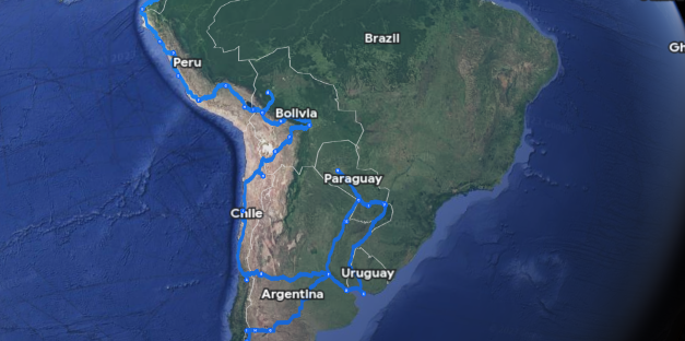

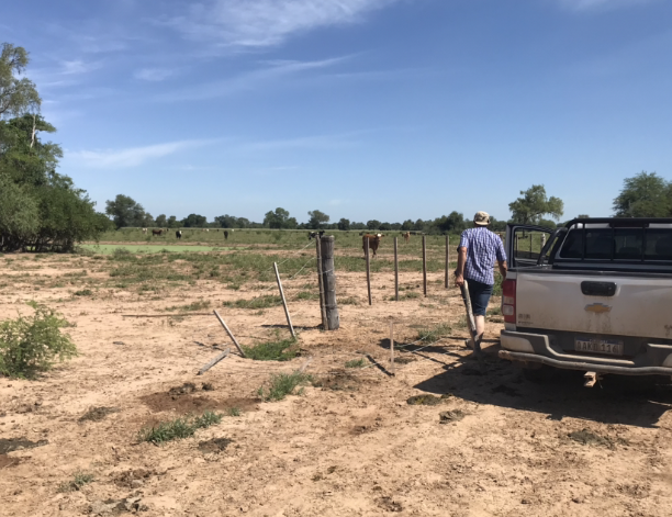
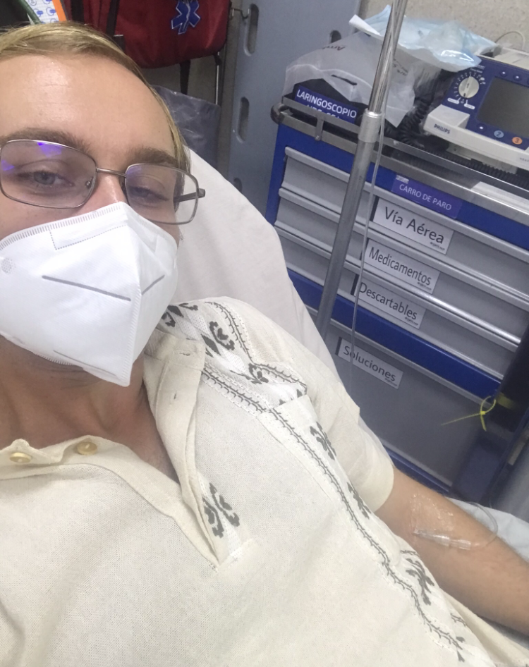

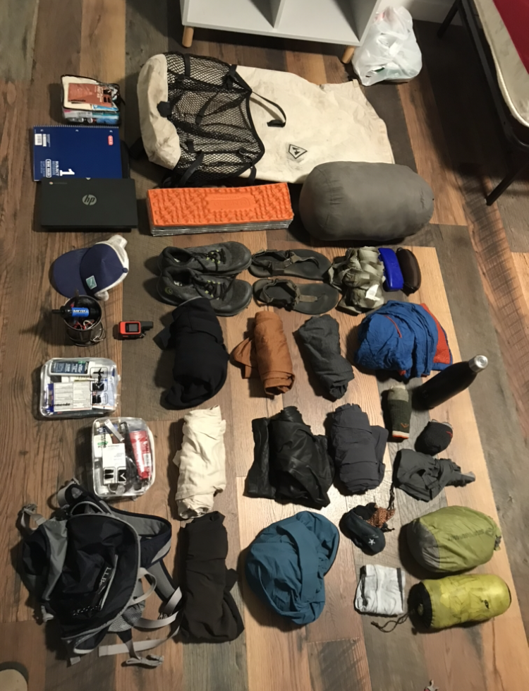
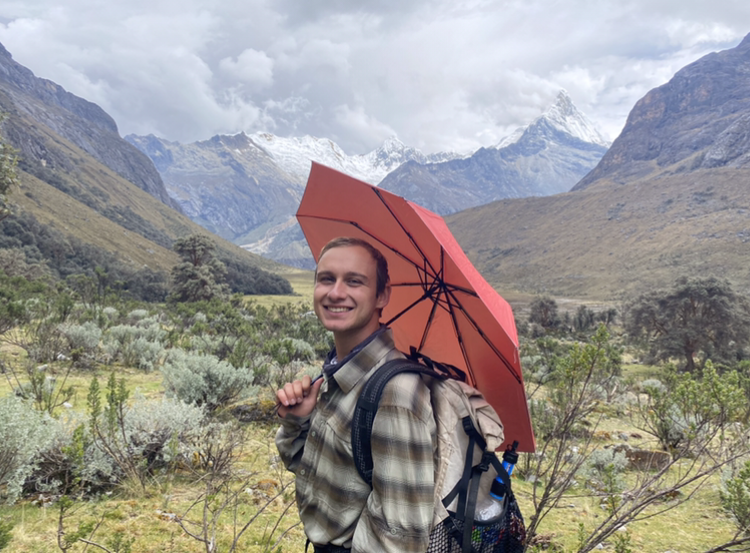
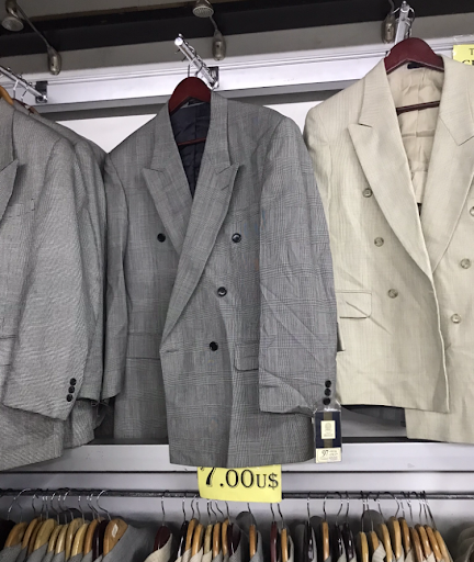

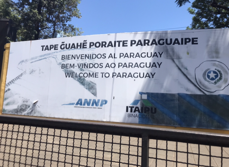
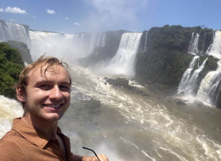

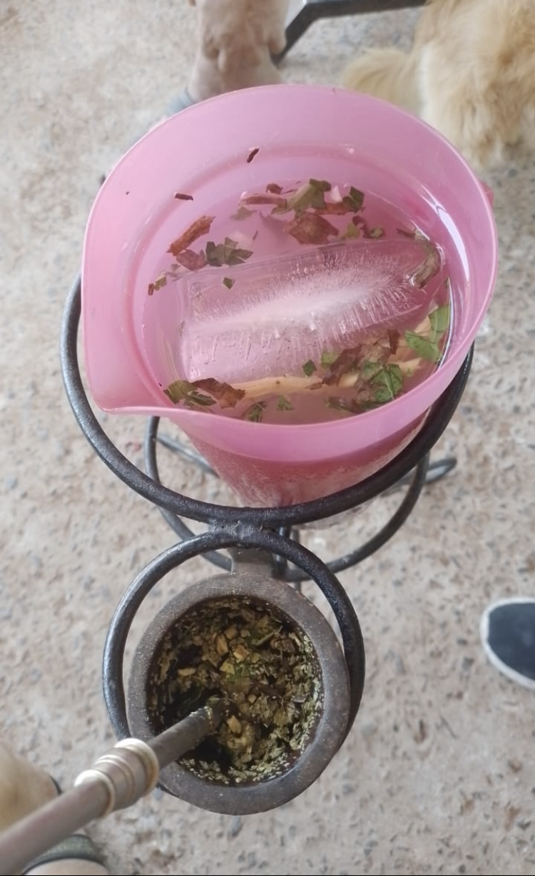
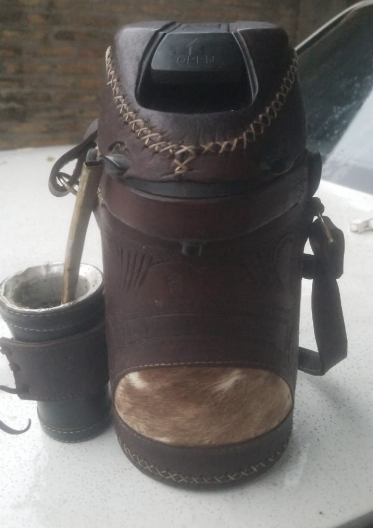


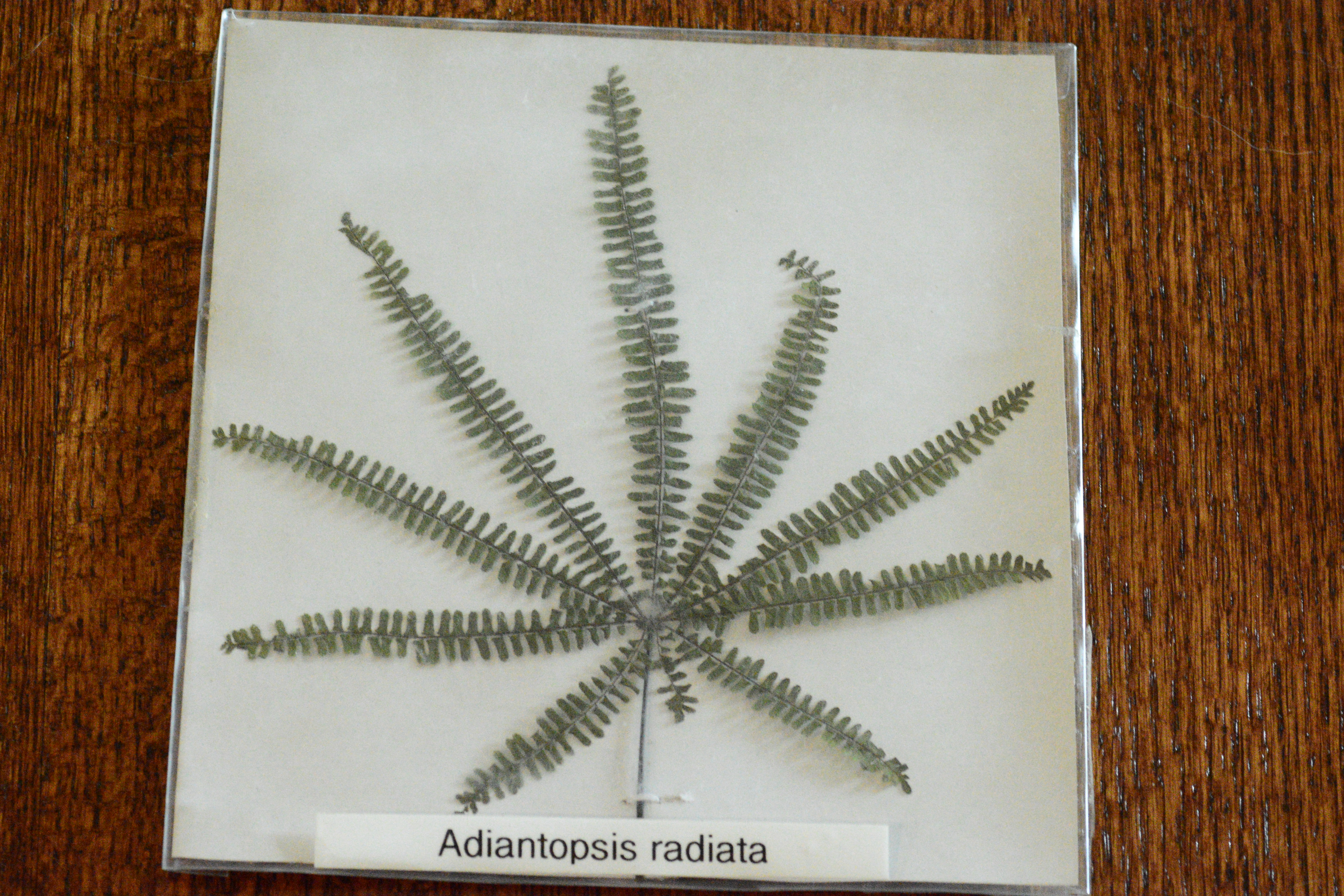
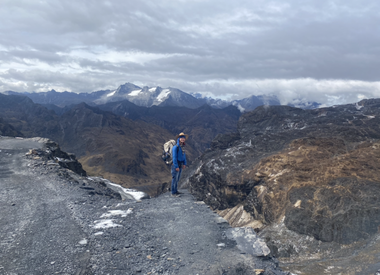
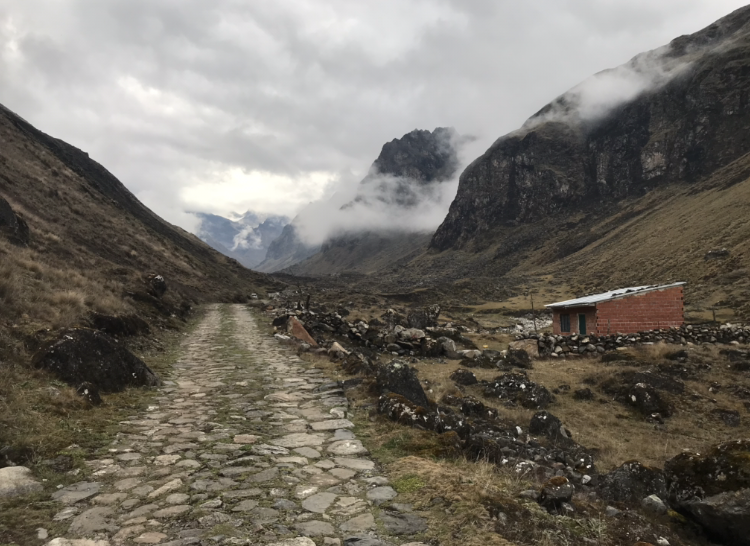


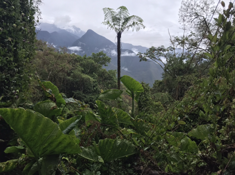
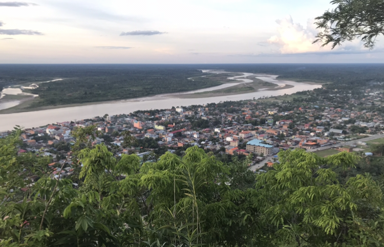
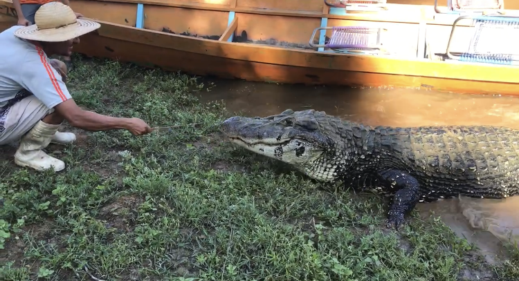
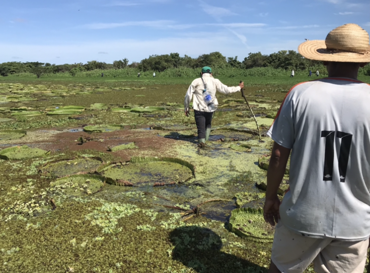


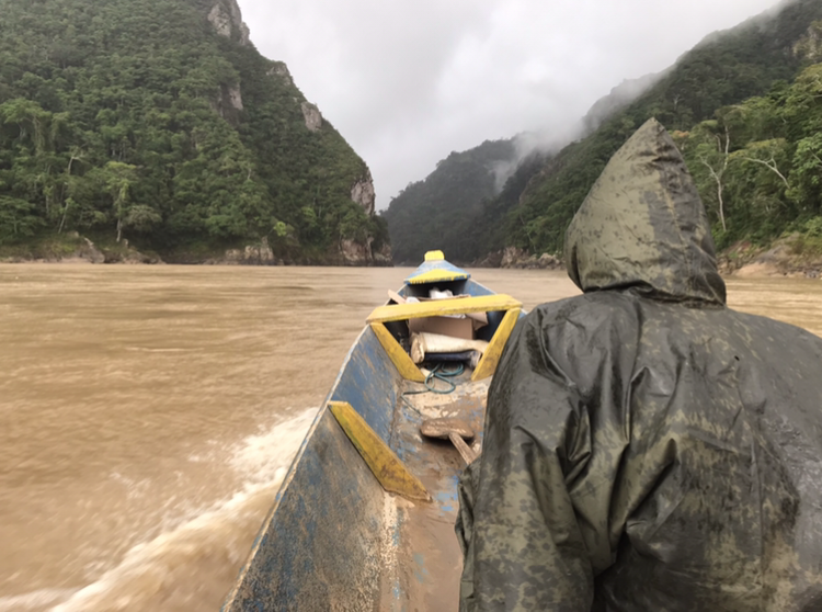
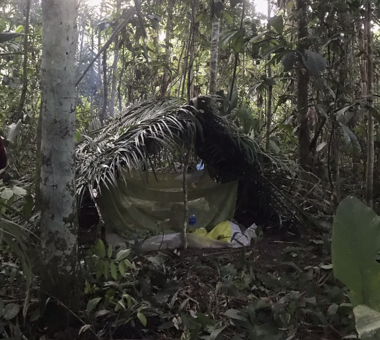


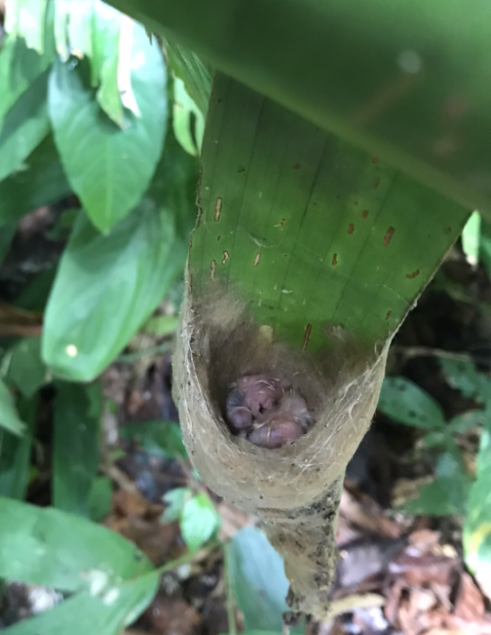
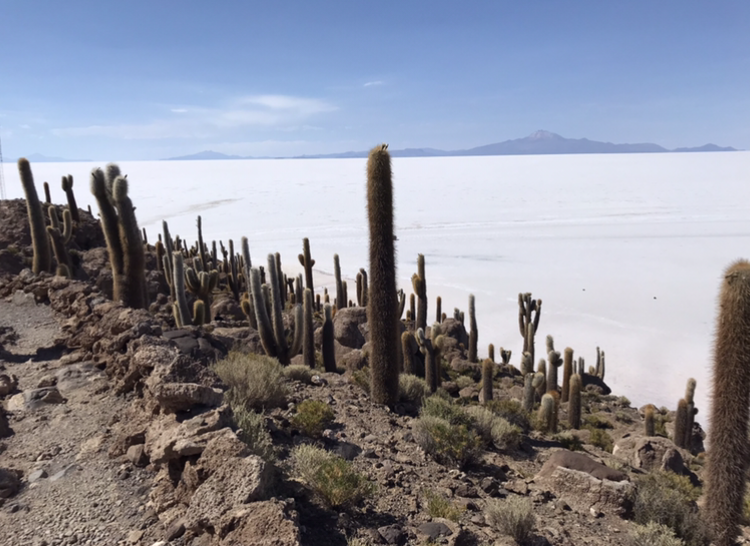
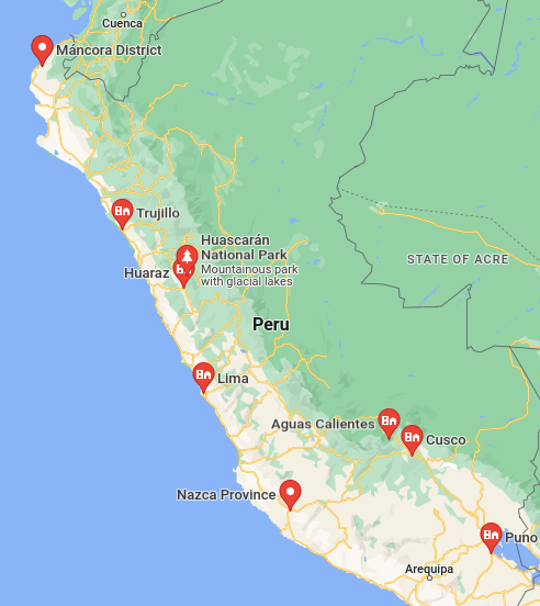
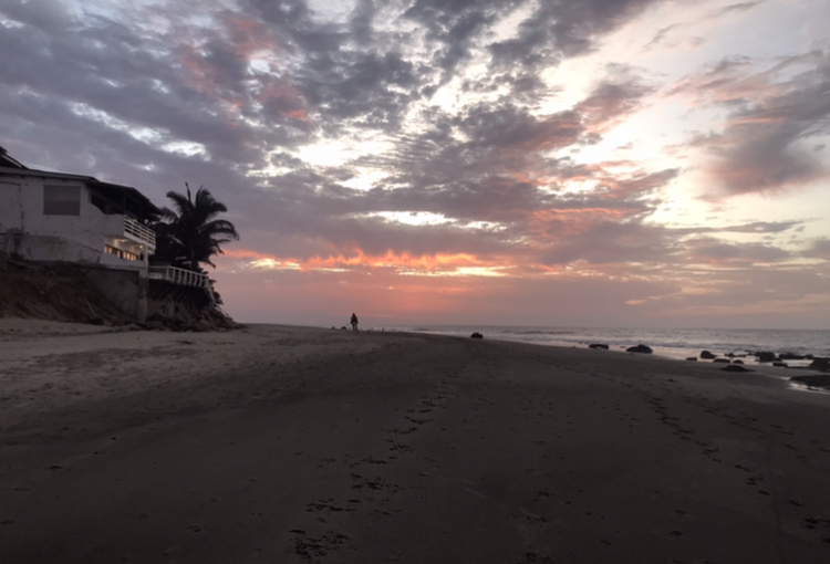
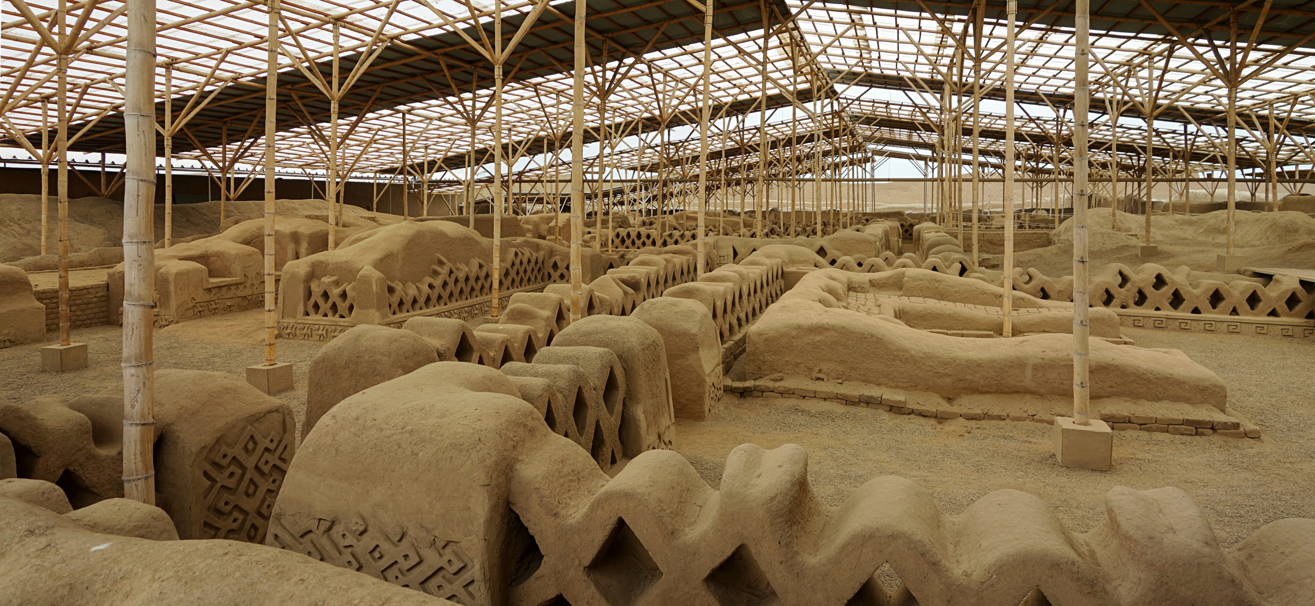
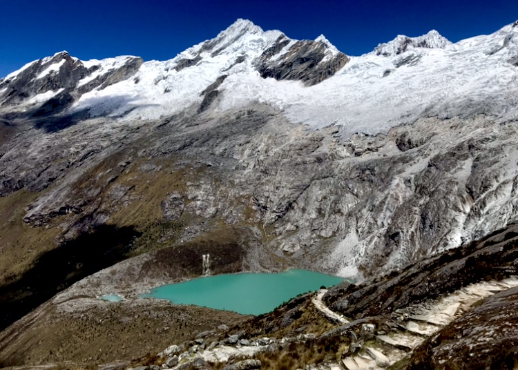
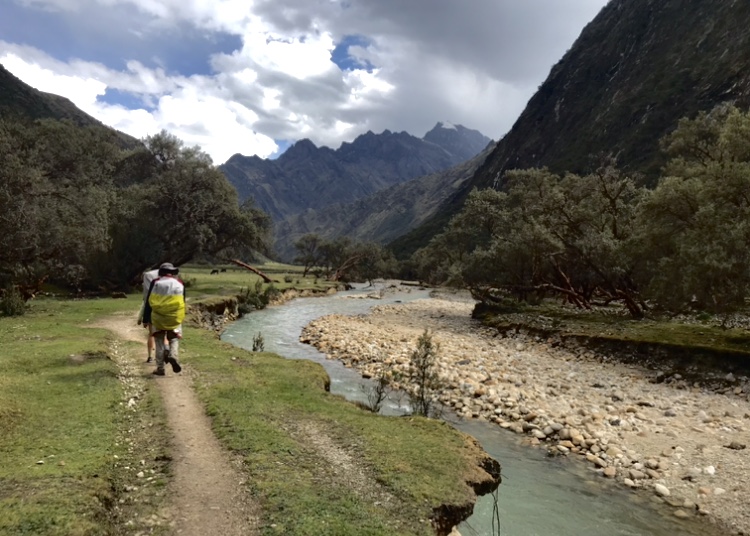
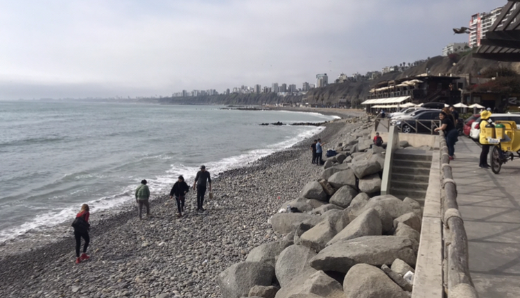
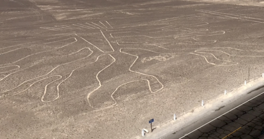
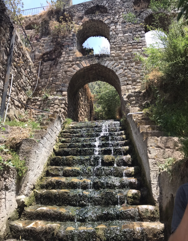
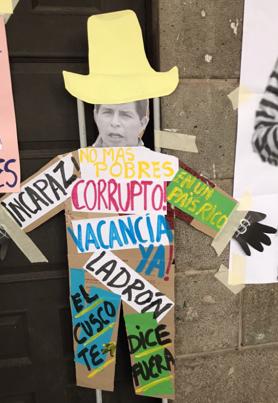
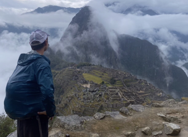
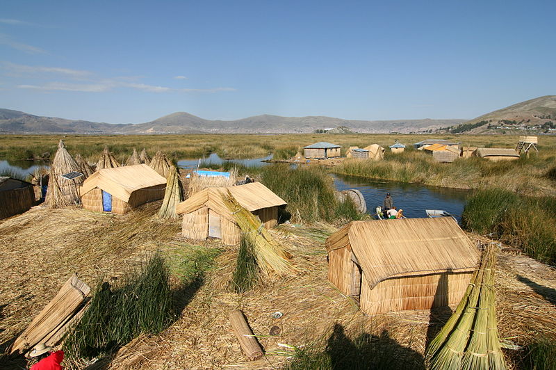
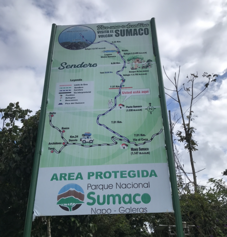

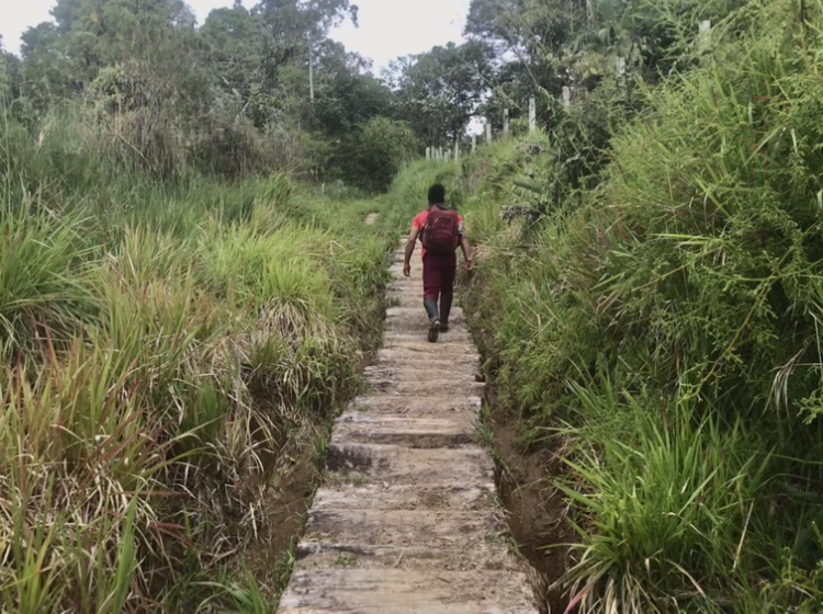
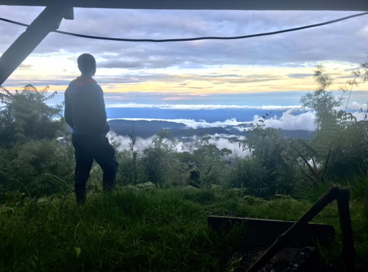

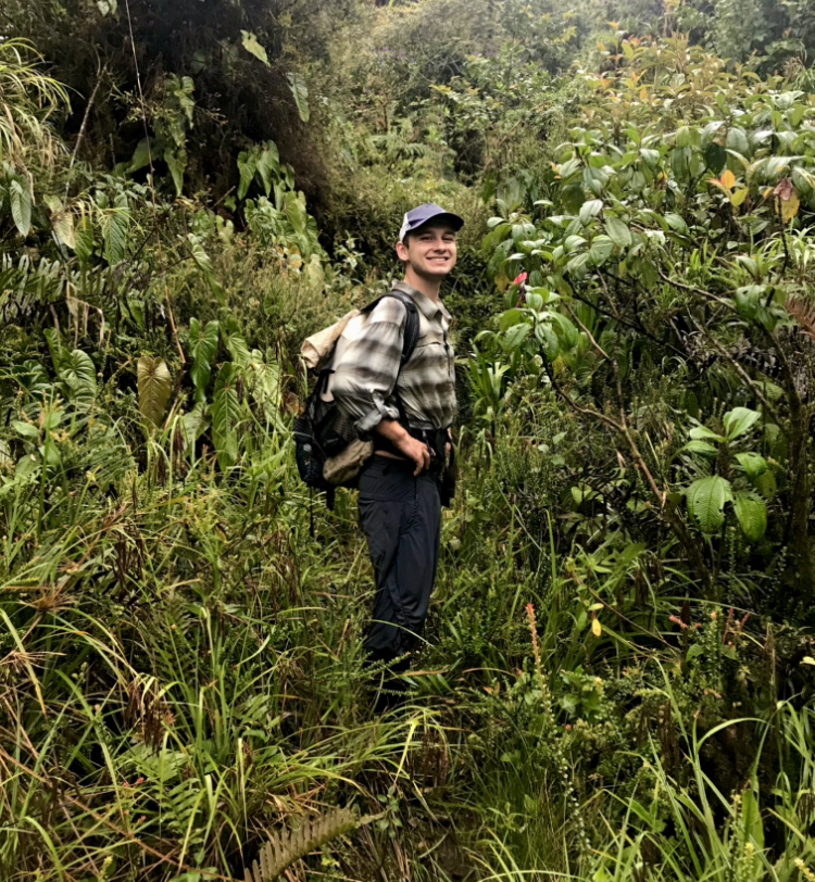
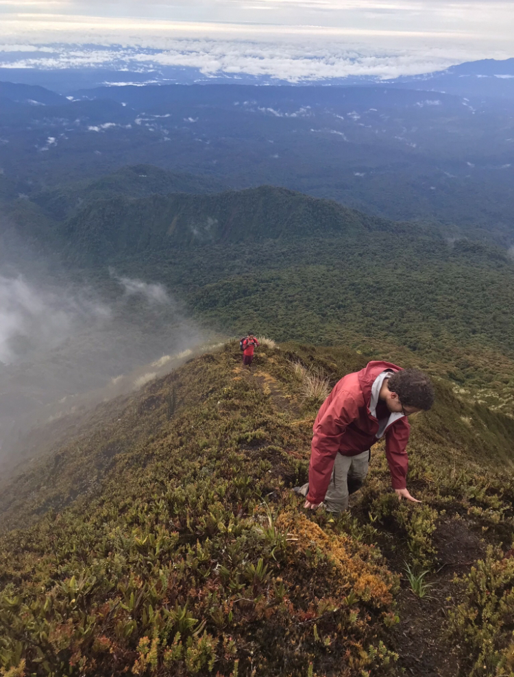
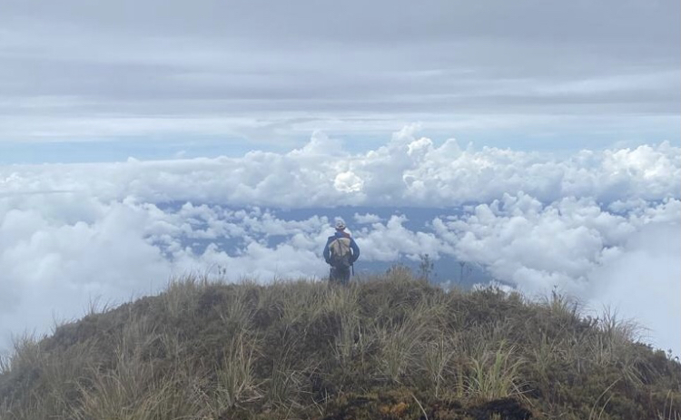

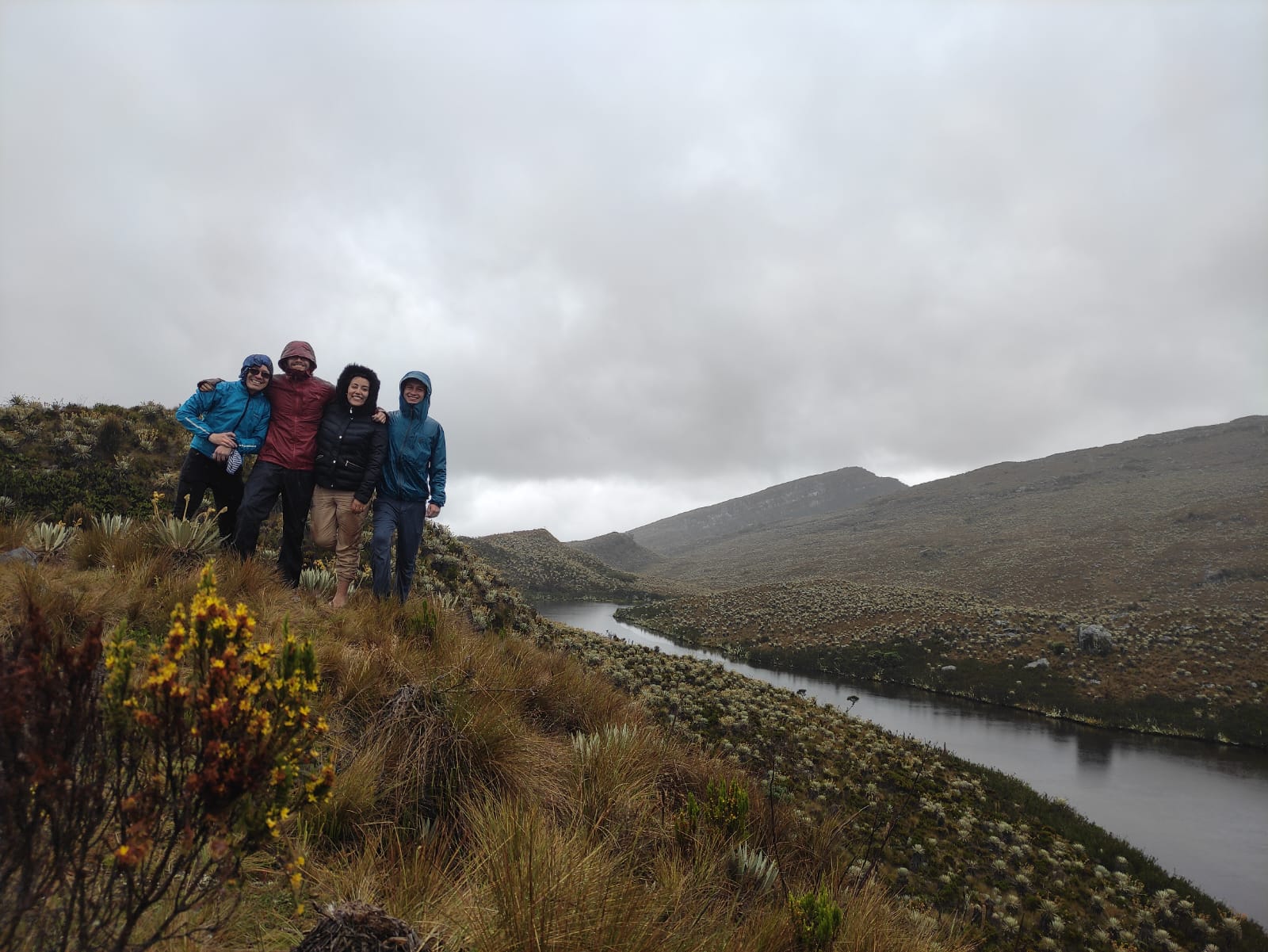
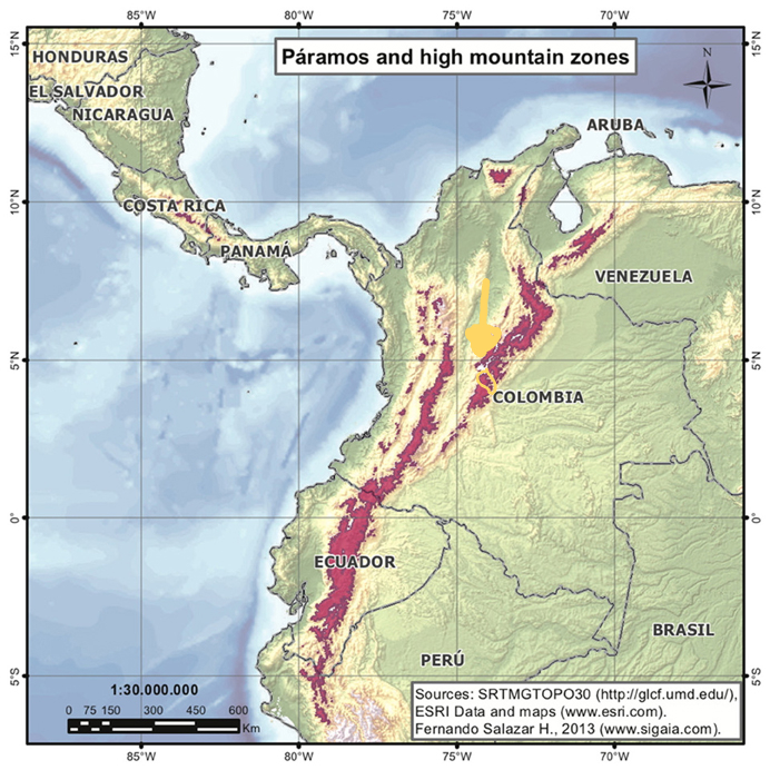

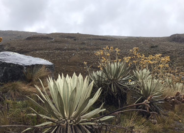
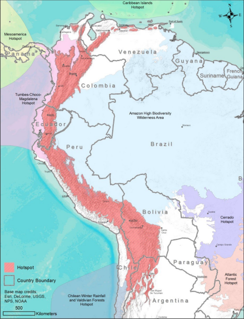
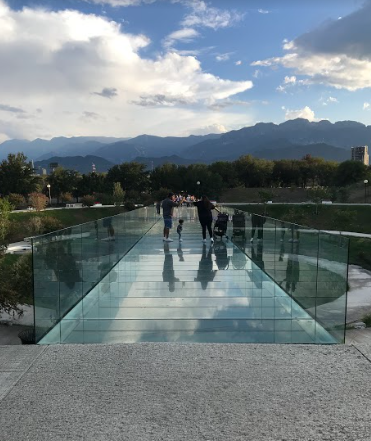
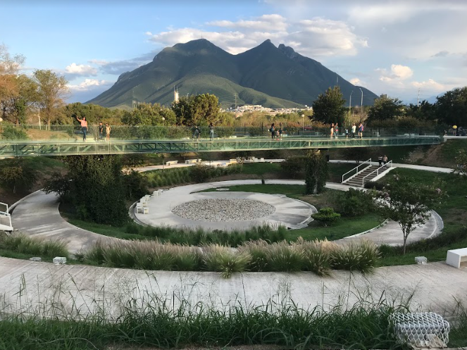

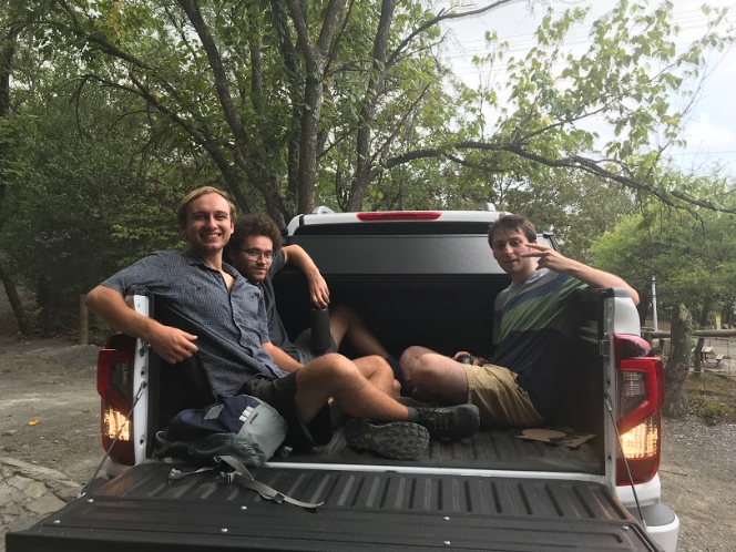
